You are here: Home > Network List > TA - USArray Transportable Network (new EarthScope stations) Stations List
> Station H34A Spellman Lake, Hanley Falls, MN, USA > Earthquake Result Viewer
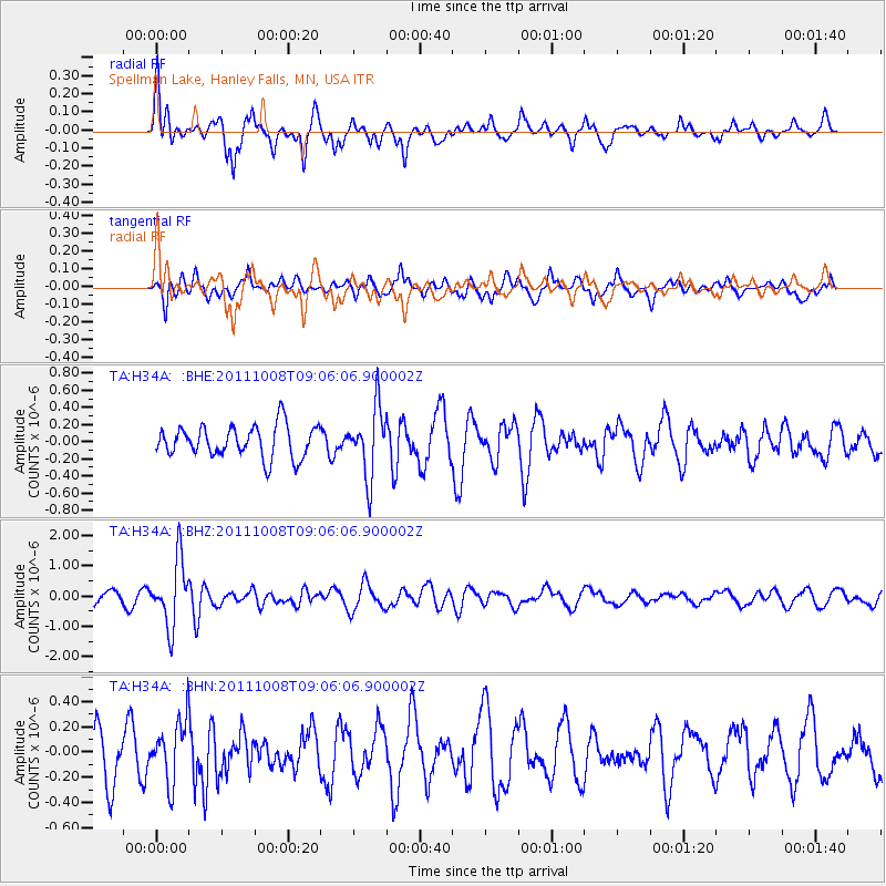
H34A Spellman Lake, Hanley Falls, MN, USA - Earthquake Result Viewer
*The percent match for this event was below the threshold and hence no stack was calculated.
| Earthquake location: |
Tonga Islands |
| Earthquake latitude/longitude: |
-20.6/-173.2 |
| Earthquake time(UTC): |
2011/10/08 (281) 08:53:11 GMT |
| Earthquake Depth: |
6.0 km |
| Earthquake Magnitude: |
6.1 MB, 5.6 MS, 5.9 MW, 5.9 MW |
| Earthquake Catalog/Contributor: |
WHDF/NEIC |
|
| Network: |
TA USArray Transportable Network (new EarthScope stations) |
| Station: |
H34A Spellman Lake, Hanley Falls, MN, USA |
| Lat/Lon: |
44.67 N/95.78 W |
| Elevation: |
329 m |
|
| Distance: |
95.7 deg |
| Az: |
44.426 deg |
| Baz: |
246.781 deg |
| Ray Param: |
$rayparam |
*The percent match for this event was below the threshold and hence was not used in the summary stack. |
|
| Radial Match: |
76.73405 % |
| Radial Bump: |
375 |
| Transverse Match: |
50.115612 % |
| Transverse Bump: |
382 |
| SOD ConfigId: |
424168 |
| Insert Time: |
2012-02-08 01:26:36.256 +0000 |
| GWidth: |
2.5 |
| Max Bumps: |
400 |
| Tol: |
0.001 |
|
Signal To Noise
| Channel | StoN | STA | LTA |
| TA:H34A: :BHZ:20111008T09:06:06.900002Z | 5.3505774 | 1.0796397E-6 | 2.0178003E-7 |
| TA:H34A: :BHN:20111008T09:06:06.900002Z | 1.2082222 | 2.392019E-7 | 1.9797841E-7 |
| TA:H34A: :BHE:20111008T09:06:06.900002Z | 2.1442919 | 3.9573996E-7 | 1.8455509E-7 |
| Arrivals |
| Ps | |
| PpPs | |
| PsPs/PpSs | |


