You are here: Home > Network List > TA - USArray Transportable Network (new EarthScope stations) Stations List
> Station J31A Geddes, SD, USA > Earthquake Result Viewer
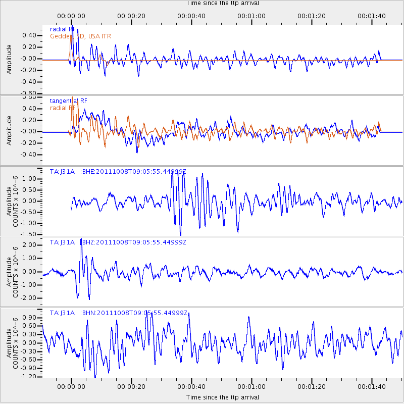
J31A Geddes, SD, USA - Earthquake Result Viewer
*The percent match for this event was below the threshold and hence no stack was calculated.
| Earthquake location: |
Tonga Islands |
| Earthquake latitude/longitude: |
-20.6/-173.2 |
| Earthquake time(UTC): |
2011/10/08 (281) 08:53:11 GMT |
| Earthquake Depth: |
6.0 km |
| Earthquake Magnitude: |
6.1 MB, 5.6 MS, 5.9 MW, 5.9 MW |
| Earthquake Catalog/Contributor: |
WHDF/NEIC |
|
| Network: |
TA USArray Transportable Network (new EarthScope stations) |
| Station: |
J31A Geddes, SD, USA |
| Lat/Lon: |
43.29 N/98.74 W |
| Elevation: |
491 m |
|
| Distance: |
93.2 deg |
| Az: |
44.802 deg |
| Baz: |
244.701 deg |
| Ray Param: |
$rayparam |
*The percent match for this event was below the threshold and hence was not used in the summary stack. |
|
| Radial Match: |
79.63568 % |
| Radial Bump: |
400 |
| Transverse Match: |
49.111187 % |
| Transverse Bump: |
400 |
| SOD ConfigId: |
424168 |
| Insert Time: |
2012-02-08 01:27:37.703 +0000 |
| GWidth: |
2.5 |
| Max Bumps: |
400 |
| Tol: |
0.001 |
|
Signal To Noise
| Channel | StoN | STA | LTA |
| TA:J31A: :BHZ:20111008T09:05:55.44999Z | 5.751882 | 1.1052474E-6 | 1.9215405E-7 |
| TA:J31A: :BHN:20111008T09:05:55.44999Z | 1.8177177 | 4.7647092E-7 | 2.6212592E-7 |
| TA:J31A: :BHE:20111008T09:05:55.44999Z | 2.8137293 | 5.3364175E-7 | 1.8965639E-7 |
| Arrivals |
| Ps | |
| PpPs | |
| PsPs/PpSs | |


