You are here: Home > Network List > TA - USArray Transportable Network (new EarthScope stations) Stations List
> Station C33A Trail, MN, USA > Earthquake Result Viewer
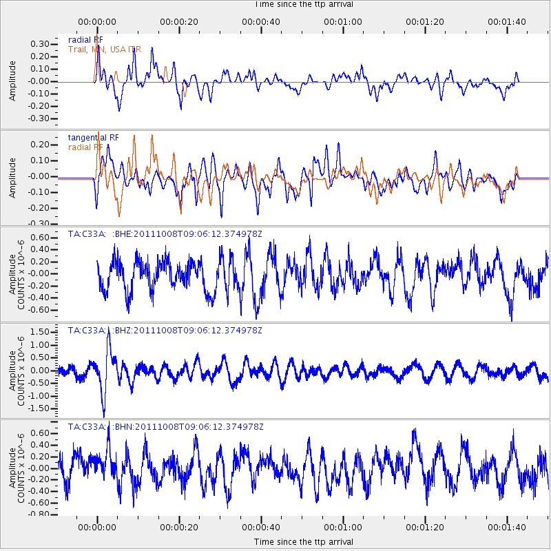
C33A Trail, MN, USA - Earthquake Result Viewer
*The percent match for this event was below the threshold and hence no stack was calculated.
| Earthquake location: |
Tonga Islands |
| Earthquake latitude/longitude: |
-20.6/-173.2 |
| Earthquake time(UTC): |
2011/10/08 (281) 08:53:11 GMT |
| Earthquake Depth: |
6.0 km |
| Earthquake Magnitude: |
6.1 MB, 5.6 MS, 5.9 MW, 5.9 MW |
| Earthquake Catalog/Contributor: |
WHDF/NEIC |
|
| Network: |
TA USArray Transportable Network (new EarthScope stations) |
| Station: |
C33A Trail, MN, USA |
| Lat/Lon: |
47.76 N/95.77 W |
| Elevation: |
388 m |
|
| Distance: |
96.9 deg |
| Az: |
41.565 deg |
| Baz: |
247.1 deg |
| Ray Param: |
$rayparam |
*The percent match for this event was below the threshold and hence was not used in the summary stack. |
|
| Radial Match: |
63.203503 % |
| Radial Bump: |
400 |
| Transverse Match: |
58.589993 % |
| Transverse Bump: |
400 |
| SOD ConfigId: |
424168 |
| Insert Time: |
2012-02-08 01:30:25.710 +0000 |
| GWidth: |
2.5 |
| Max Bumps: |
400 |
| Tol: |
0.001 |
|
Signal To Noise
| Channel | StoN | STA | LTA |
| TA:C33A: :BHZ:20111008T09:06:12.374978Z | 3.8140018 | 8.483864E-7 | 2.2243995E-7 |
| TA:C33A: :BHN:20111008T09:06:12.374978Z | 1.4122127 | 2.7675657E-7 | 1.9597371E-7 |
| TA:C33A: :BHE:20111008T09:06:12.374978Z | 1.1461024 | 2.502888E-7 | 2.1838257E-7 |
| Arrivals |
| Ps | |
| PpPs | |
| PsPs/PpSs | |


