You are here: Home > Network List > TA - USArray Transportable Network (new EarthScope stations) Stations List
> Station K37A Belmond, IA, USA > Earthquake Result Viewer
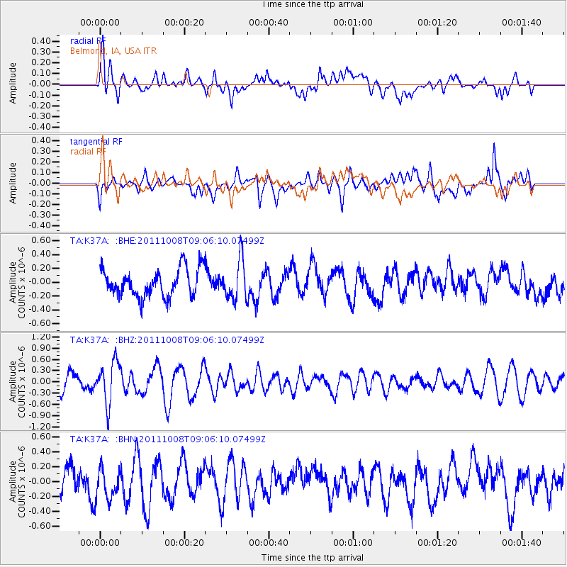
K37A Belmond, IA, USA - Earthquake Result Viewer
*The percent match for this event was below the threshold and hence no stack was calculated.
| Earthquake location: |
Tonga Islands |
| Earthquake latitude/longitude: |
-20.6/-173.2 |
| Earthquake time(UTC): |
2011/10/08 (281) 08:53:11 GMT |
| Earthquake Depth: |
6.0 km |
| Earthquake Magnitude: |
6.1 MB, 5.6 MS, 5.9 MW, 5.9 MW |
| Earthquake Catalog/Contributor: |
WHDF/NEIC |
|
| Network: |
TA USArray Transportable Network (new EarthScope stations) |
| Station: |
K37A Belmond, IA, USA |
| Lat/Lon: |
42.77 N/93.64 W |
| Elevation: |
365 m |
|
| Distance: |
96.4 deg |
| Az: |
46.789 deg |
| Baz: |
248.004 deg |
| Ray Param: |
$rayparam |
*The percent match for this event was below the threshold and hence was not used in the summary stack. |
|
| Radial Match: |
53.09491 % |
| Radial Bump: |
400 |
| Transverse Match: |
59.503334 % |
| Transverse Bump: |
400 |
| SOD ConfigId: |
424168 |
| Insert Time: |
2012-02-08 01:32:32.094 +0000 |
| GWidth: |
2.5 |
| Max Bumps: |
400 |
| Tol: |
0.001 |
|
Signal To Noise
| Channel | StoN | STA | LTA |
| TA:K37A: :BHZ:20111008T09:06:10.07499Z | 2.5431306 | 5.6226975E-7 | 2.2109354E-7 |
| TA:K37A: :BHN:20111008T09:06:10.07499Z | 0.8526042 | 2.0648808E-7 | 2.4218517E-7 |
| TA:K37A: :BHE:20111008T09:06:10.07499Z | 1.4660692 | 2.949057E-7 | 2.0115401E-7 |
| Arrivals |
| Ps | |
| PpPs | |
| PsPs/PpSs | |


