You are here: Home > Network List > UW - Pacific Northwest Regional Seismic Network Stations List
> Station LEBA Lebam, WA, USA > Earthquake Result Viewer
LEBA Lebam, WA, USA - Earthquake Result Viewer
*The percent match for this event was below the threshold and hence no stack was calculated.
| Earthquake location: |
Tonga Islands |
| Earthquake latitude/longitude: |
-20.6/-173.2 |
| Earthquake time(UTC): |
2011/10/08 (281) 08:53:11 GMT |
| Earthquake Depth: |
6.0 km |
| Earthquake Magnitude: |
6.1 MB, 5.6 MS, 5.9 MW, 5.9 MW |
| Earthquake Catalog/Contributor: |
WHDF/NEIC |
|
| Network: |
UW Pacific Northwest Regional Seismic Network |
| Station: |
LEBA Lebam, WA, USA |
| Lat/Lon: |
46.55 N/123.56 W |
| Elevation: |
73 m |
|
| Distance: |
80.5 deg |
| Az: |
32.237 deg |
| Baz: |
226.388 deg |
| Ray Param: |
$rayparam |
*The percent match for this event was below the threshold and hence was not used in the summary stack. |
|
| Radial Match: |
73.91145 % |
| Radial Bump: |
400 |
| Transverse Match: |
77.71092 % |
| Transverse Bump: |
400 |
| SOD ConfigId: |
424168 |
| Insert Time: |
2012-02-08 01:43:49.169 +0000 |
| GWidth: |
2.5 |
| Max Bumps: |
400 |
| Tol: |
0.001 |
|
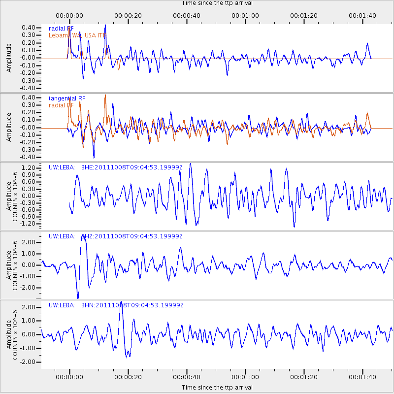
Signal To Noise
| Channel | StoN | STA | LTA |
| UW:LEBA: :BHZ:20111008T09:04:53.19999Z | 5.6496496 | 1.4837764E-6 | 2.6263157E-7 |
| UW:LEBA: :BHN:20111008T09:04:53.19999Z | 1.2833731 | 5.357029E-7 | 4.174179E-7 |
| UW:LEBA: :BHE:20111008T09:04:53.19999Z | 1.3157271 | 4.77459E-7 | 3.6288606E-7 |
| Arrivals |
| Ps | |
| PpPs | |
| PsPs/PpSs | |


