You are here: Home > Network List > UW - Pacific Northwest Regional Seismic Network Stations List
> Station MRBL Marblemount, WA, USA > Earthquake Result Viewer
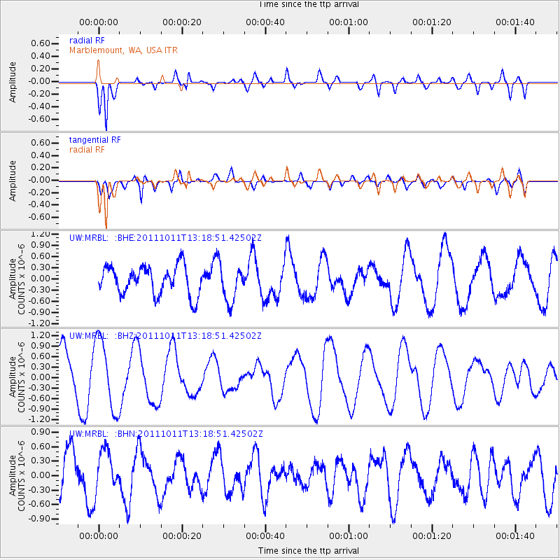
MRBL Marblemount, WA, USA - Earthquake Result Viewer
*The percent match for this event was below the threshold and hence no stack was calculated.
| Earthquake location: |
Irian Jaya, Indonesia |
| Earthquake latitude/longitude: |
-2.2/138.8 |
| Earthquake time(UTC): |
2011/10/11 (284) 13:05:49 GMT |
| Earthquake Depth: |
27 km |
| Earthquake Magnitude: |
5.6 MB, 5.6 MS, 5.7 MW, 5.6 MW |
| Earthquake Catalog/Contributor: |
WHDF/NEIC |
|
| Network: |
UW Pacific Northwest Regional Seismic Network |
| Station: |
MRBL Marblemount, WA, USA |
| Lat/Lon: |
48.52 N/121.48 W |
| Elevation: |
75 m |
|
| Distance: |
98.1 deg |
| Az: |
41.453 deg |
| Baz: |
275.772 deg |
| Ray Param: |
$rayparam |
*The percent match for this event was below the threshold and hence was not used in the summary stack. |
|
| Radial Match: |
87.12652 % |
| Radial Bump: |
400 |
| Transverse Match: |
44.44633 % |
| Transverse Bump: |
400 |
| SOD ConfigId: |
424168 |
| Insert Time: |
2012-02-08 02:02:23.777 +0000 |
| GWidth: |
2.5 |
| Max Bumps: |
400 |
| Tol: |
0.001 |
|
Signal To Noise
| Channel | StoN | STA | LTA |
| UW:MRBL: :BHZ:20111011T13:18:51.42502Z | 2.2366493 | 1.0255153E-6 | 4.5850518E-7 |
| UW:MRBL: :BHN:20111011T13:18:51.42502Z | 0.99078083 | 4.1322713E-7 | 4.170722E-7 |
| UW:MRBL: :BHE:20111011T13:18:51.42502Z | 1.257053 | 4.784819E-7 | 3.8063786E-7 |
| Arrivals |
| Ps | |
| PpPs | |
| PsPs/PpSs | |


