You are here: Home > Network List > UW - Pacific Northwest Regional Seismic Network Stations List
> Station MRBL Marblemount, WA, USA > Earthquake Result Viewer
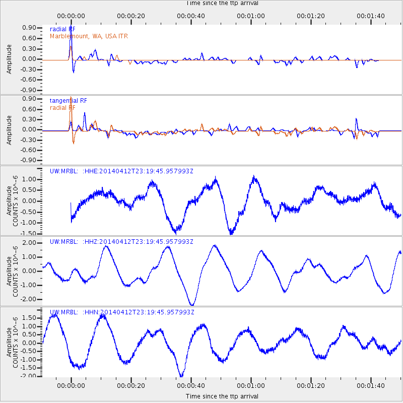
MRBL Marblemount, WA, USA - Earthquake Result Viewer
*The percent match for this event was below the threshold and hence no stack was calculated.
| Earthquake location: |
Solomon Islands |
| Earthquake latitude/longitude: |
-11.7/162.8 |
| Earthquake time(UTC): |
2014/04/12 (102) 23:07:18 GMT |
| Earthquake Depth: |
0.0 km |
| Earthquake Magnitude: |
4.2 mb |
| Earthquake Catalog/Contributor: |
ISC/ISC |
|
| Network: |
UW Pacific Northwest Regional Seismic Network |
| Station: |
MRBL Marblemount, WA, USA |
| Lat/Lon: |
48.52 N/121.48 W |
| Elevation: |
75 m |
|
| Distance: |
89.4 deg |
| Az: |
40.116 deg |
| Baz: |
251.648 deg |
| Ray Param: |
$rayparam |
*The percent match for this event was below the threshold and hence was not used in the summary stack. |
|
| Radial Match: |
52.030193 % |
| Radial Bump: |
400 |
| Transverse Match: |
44.49752 % |
| Transverse Bump: |
400 |
| SOD ConfigId: |
3390531 |
| Insert Time: |
2019-04-11 08:31:33.623 +0000 |
| GWidth: |
2.5 |
| Max Bumps: |
400 |
| Tol: |
0.001 |
|
Signal To Noise
| Channel | StoN | STA | LTA |
| UW:MRBL: :HHZ:20140412T23:19:45.957993Z | 1.0799648 | 4.3074772E-7 | 3.9885347E-7 |
| UW:MRBL: :HHN:20140412T23:19:45.957993Z | 1.1828705 | 1.2312731E-6 | 1.0409196E-6 |
| UW:MRBL: :HHE:20140412T23:19:45.957993Z | 2.7762086 | 8.520001E-7 | 3.068934E-7 |
| Arrivals |
| Ps | |
| PpPs | |
| PsPs/PpSs | |


