You are here: Home > Network List > CI - Caltech Regional Seismic Network Stations List
> Station SMM Simmler, CA, USA > Earthquake Result Viewer
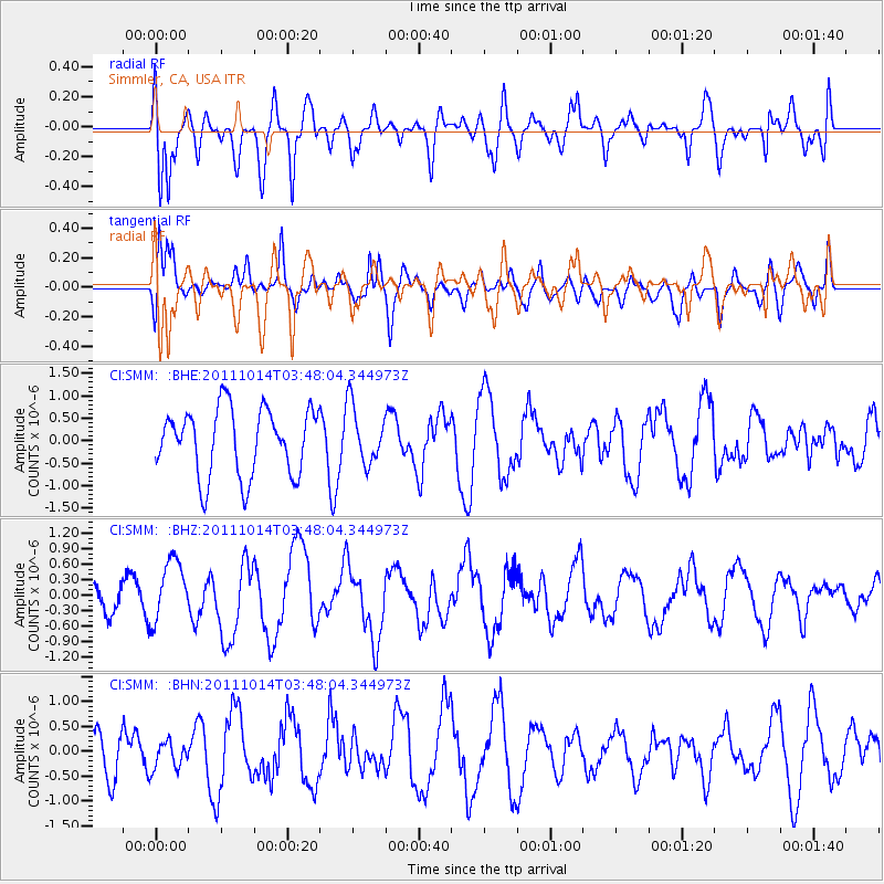
SMM Simmler, CA, USA - Earthquake Result Viewer
*The percent match for this event was below the threshold and hence no stack was calculated.
| Earthquake location: |
Eastern New Guinea Reg., P.N.G. |
| Earthquake latitude/longitude: |
-6.6/147.9 |
| Earthquake time(UTC): |
2011/10/14 (287) 03:35:14 GMT |
| Earthquake Depth: |
37 km |
| Earthquake Magnitude: |
5.7 MB, 6.5 MS, 6.5 MW, 6.5 MW |
| Earthquake Catalog/Contributor: |
WHDF/NEIC |
|
| Network: |
CI Caltech Regional Seismic Network |
| Station: |
SMM Simmler, CA, USA |
| Lat/Lon: |
35.31 N/120.00 W |
| Elevation: |
599 m |
|
| Distance: |
95.5 deg |
| Az: |
55.186 deg |
| Baz: |
265.865 deg |
| Ray Param: |
$rayparam |
*The percent match for this event was below the threshold and hence was not used in the summary stack. |
|
| Radial Match: |
68.09844 % |
| Radial Bump: |
400 |
| Transverse Match: |
59.381016 % |
| Transverse Bump: |
400 |
| SOD ConfigId: |
424168 |
| Insert Time: |
2012-02-08 02:31:28.016 +0000 |
| GWidth: |
2.5 |
| Max Bumps: |
400 |
| Tol: |
0.001 |
|
Signal To Noise
| Channel | StoN | STA | LTA |
| CI:SMM: :BHZ:20111014T03:48:04.344973Z | 2.289719 | 5.9488184E-7 | 2.5980557E-7 |
| CI:SMM: :BHN:20111014T03:48:04.344973Z | 0.63488305 | 2.830266E-7 | 4.4579326E-7 |
| CI:SMM: :BHE:20111014T03:48:04.344973Z | 0.86834776 | 6.4585856E-7 | 7.437787E-7 |
| Arrivals |
| Ps | |
| PpPs | |
| PsPs/PpSs | |


