You are here: Home > Network List > UW - Pacific Northwest Regional Seismic Network Stations List
> Station OMAK Colville Reservation, Omak, WA, USA > Earthquake Result Viewer
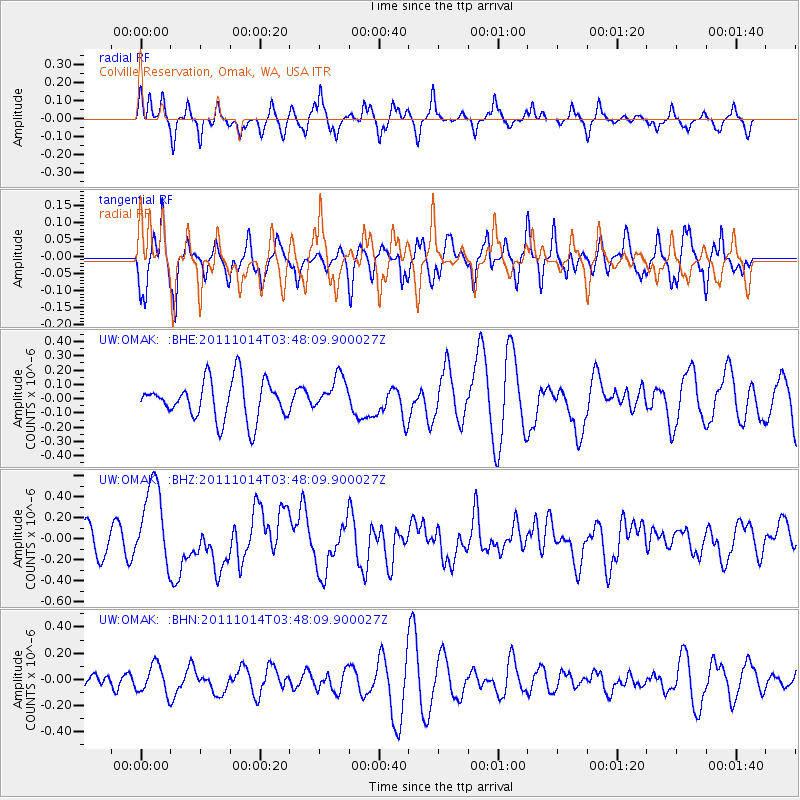
OMAK Colville Reservation, Omak, WA, USA - Earthquake Result Viewer
*The percent match for this event was below the threshold and hence no stack was calculated.
| Earthquake location: |
Eastern New Guinea Reg., P.N.G. |
| Earthquake latitude/longitude: |
-6.6/147.9 |
| Earthquake time(UTC): |
2011/10/14 (287) 03:35:14 GMT |
| Earthquake Depth: |
37 km |
| Earthquake Magnitude: |
5.7 MB, 6.5 MS, 6.5 MW, 6.5 MW |
| Earthquake Catalog/Contributor: |
WHDF/NEIC |
|
| Network: |
UW Pacific Northwest Regional Seismic Network |
| Station: |
OMAK Colville Reservation, Omak, WA, USA |
| Lat/Lon: |
48.36 N/119.33 W |
| Elevation: |
696 m |
|
| Distance: |
96.7 deg |
| Az: |
42.126 deg |
| Baz: |
267.702 deg |
| Ray Param: |
$rayparam |
*The percent match for this event was below the threshold and hence was not used in the summary stack. |
|
| Radial Match: |
59.041138 % |
| Radial Bump: |
302 |
| Transverse Match: |
58.079483 % |
| Transverse Bump: |
314 |
| SOD ConfigId: |
424168 |
| Insert Time: |
2012-02-08 02:36:51.753 +0000 |
| GWidth: |
2.5 |
| Max Bumps: |
400 |
| Tol: |
0.001 |
|
Signal To Noise
| Channel | StoN | STA | LTA |
| UW:OMAK: :BHZ:20111014T03:48:09.900027Z | 2.526631 | 3.9877062E-7 | 1.57827E-7 |
| UW:OMAK: :BHN:20111014T03:48:09.900027Z | 1.1003035 | 1.0860969E-7 | 9.8708846E-8 |
| UW:OMAK: :BHE:20111014T03:48:09.900027Z | 0.8834145 | 1.2025835E-7 | 1.3612902E-7 |
| Arrivals |
| Ps | |
| PpPs | |
| PsPs/PpSs | |


