You are here: Home > Network List > UW - Pacific Northwest Regional Seismic Network Stations List
> Station MRBL Marblemount, WA, USA > Earthquake Result Viewer
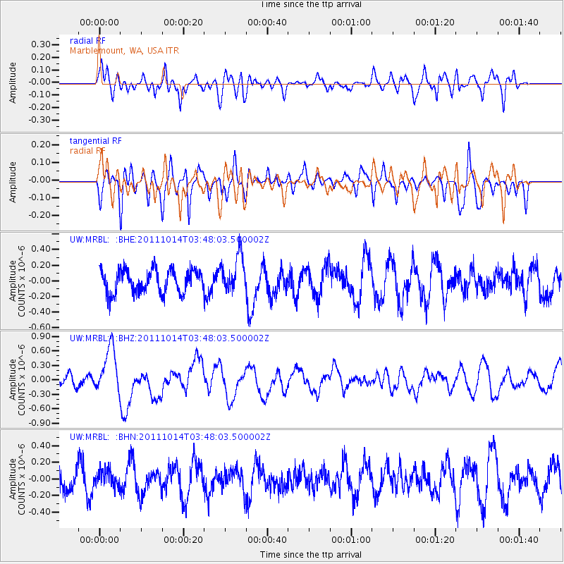
MRBL Marblemount, WA, USA - Earthquake Result Viewer
*The percent match for this event was below the threshold and hence no stack was calculated.
| Earthquake location: |
Eastern New Guinea Reg., P.N.G. |
| Earthquake latitude/longitude: |
-6.6/147.9 |
| Earthquake time(UTC): |
2011/10/14 (287) 03:35:14 GMT |
| Earthquake Depth: |
37 km |
| Earthquake Magnitude: |
5.7 MB, 6.5 MS, 6.5 MW, 6.5 MW |
| Earthquake Catalog/Contributor: |
WHDF/NEIC |
|
| Network: |
UW Pacific Northwest Regional Seismic Network |
| Station: |
MRBL Marblemount, WA, USA |
| Lat/Lon: |
48.52 N/121.48 W |
| Elevation: |
75 m |
|
| Distance: |
95.3 deg |
| Az: |
41.888 deg |
| Baz: |
266.122 deg |
| Ray Param: |
$rayparam |
*The percent match for this event was below the threshold and hence was not used in the summary stack. |
|
| Radial Match: |
54.018196 % |
| Radial Bump: |
400 |
| Transverse Match: |
51.437695 % |
| Transverse Bump: |
400 |
| SOD ConfigId: |
424168 |
| Insert Time: |
2012-02-08 02:36:53.054 +0000 |
| GWidth: |
2.5 |
| Max Bumps: |
400 |
| Tol: |
0.001 |
|
Signal To Noise
| Channel | StoN | STA | LTA |
| UW:MRBL: :BHZ:20111014T03:48:03.500002Z | 4.0046115 | 4.92168E-7 | 1.229003E-7 |
| UW:MRBL: :BHN:20111014T03:48:03.500002Z | 0.7264899 | 9.798199E-8 | 1.348704E-7 |
| UW:MRBL: :BHE:20111014T03:48:03.500002Z | 1.663533 | 2.446816E-7 | 1.4708552E-7 |
| Arrivals |
| Ps | |
| PpPs | |
| PsPs/PpSs | |


