You are here: Home > Network List > UW - Pacific Northwest Regional Seismic Network Stations List
> Station LEBA Lebam, WA, USA > Earthquake Result Viewer
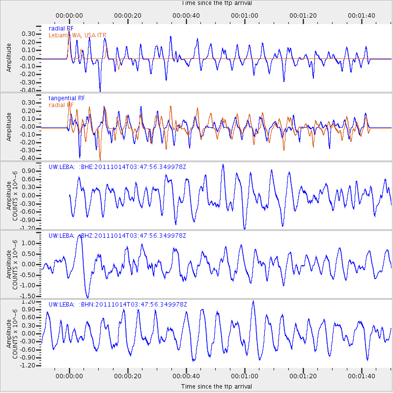
LEBA Lebam, WA, USA - Earthquake Result Viewer
*The percent match for this event was below the threshold and hence no stack was calculated.
| Earthquake location: |
Eastern New Guinea Reg., P.N.G. |
| Earthquake latitude/longitude: |
-6.6/147.9 |
| Earthquake time(UTC): |
2011/10/14 (287) 03:35:14 GMT |
| Earthquake Depth: |
37 km |
| Earthquake Magnitude: |
5.7 MB, 6.5 MS, 6.5 MW, 6.5 MW |
| Earthquake Catalog/Contributor: |
WHDF/NEIC |
|
| Network: |
UW Pacific Northwest Regional Seismic Network |
| Station: |
LEBA Lebam, WA, USA |
| Lat/Lon: |
46.55 N/123.56 W |
| Elevation: |
73 m |
|
| Distance: |
93.7 deg |
| Az: |
43.745 deg |
| Baz: |
264.447 deg |
| Ray Param: |
$rayparam |
*The percent match for this event was below the threshold and hence was not used in the summary stack. |
|
| Radial Match: |
65.47454 % |
| Radial Bump: |
400 |
| Transverse Match: |
69.416985 % |
| Transverse Bump: |
400 |
| SOD ConfigId: |
424168 |
| Insert Time: |
2012-02-08 02:37:08.358 +0000 |
| GWidth: |
2.5 |
| Max Bumps: |
400 |
| Tol: |
0.001 |
|
Signal To Noise
| Channel | StoN | STA | LTA |
| UW:LEBA: :BHZ:20111014T03:47:56.349978Z | 3.7011828 | 8.28434E-7 | 2.2382953E-7 |
| UW:LEBA: :BHN:20111014T03:47:56.349978Z | 0.35531354 | 1.9731712E-7 | 5.553324E-7 |
| UW:LEBA: :BHE:20111014T03:47:56.349978Z | 1.4150279 | 4.8864007E-7 | 3.4532187E-7 |
| Arrivals |
| Ps | |
| PpPs | |
| PsPs/PpSs | |


