FDF Fort de France, Martinique France - Earthquake Result Viewer
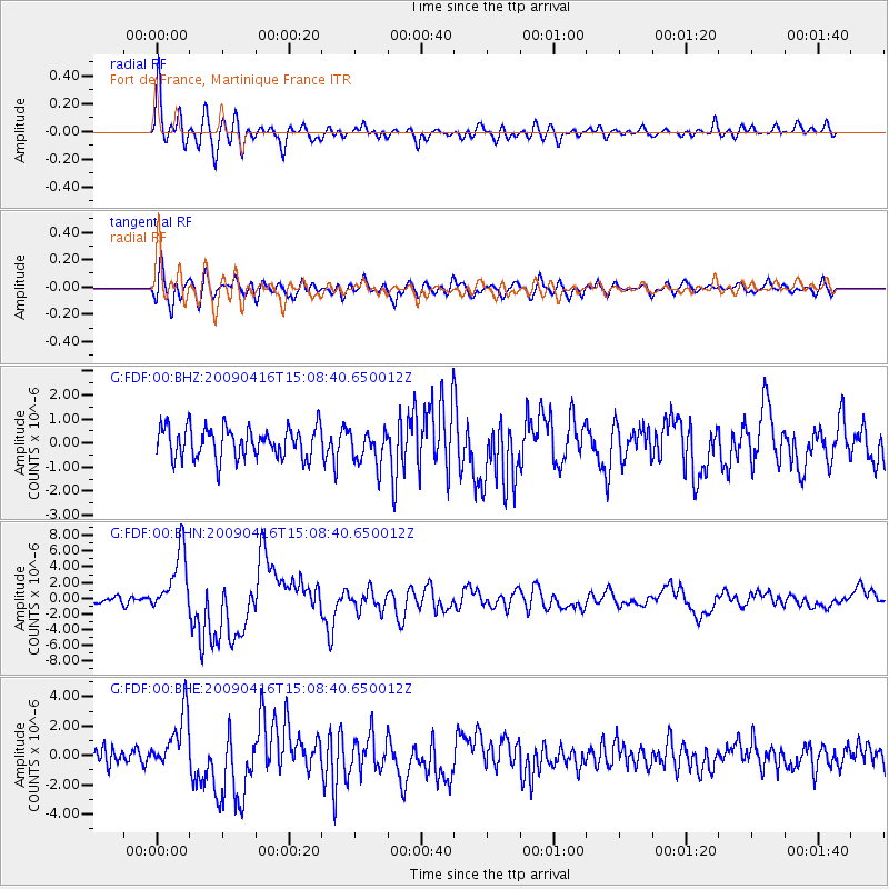
Earthquake location: South Sandwich Islands Region
Earthquake latitude/longitude: -60.2/-26.9
Earthquake time(UTC): 2009/04/16 (106) 14:57:06 GMT
Earthquake Depth: 20 km
Earthquake Magnitude: 6.2 MB, 6.8 MS, 6.7 MW, 6.7 MW
Earthquake Catalog/Contributor: WHDF/NEIC
Network: G GEOSCOPE
Station: FDF Fort de France, Martinique France
Lat/Lon: 14.73 N/61.14 W
Elevation: 467 m
Distance: 79.6 deg
Az: 326.351 deg
Baz: 163.38 deg
Ray Param: 0.048822377
Estimated Moho Depth: 16.25 km
Estimated Crust Vp/Vs: 1.67
Assumed Crust Vp: 5.88 km/s
Estimated Crust Vs: 3.521 km/s
Estimated Crust Poisson's Ratio: 0.22
Radial Match: 85.086494 %
Radial Bump: 400
Transverse Match: 80.06045 %
Transverse Bump: 400
SOD ConfigId: 2658
Insert Time: 2010-02-26 22:33:00.178 +0000
GWidth: 2.5
Max Bumps: 400
Tol: 0.001

Signal To Noise

ChannelStoNSTALTA
G:FDF:00:BHN:20090416T15:08:40.650012Z8.9455984.0393847E-64.5155002E-7
G:FDF:00:BHE:20090416T15:08:40.650012Z2.86739441.9370914E-66.75558E-7
G:FDF:00:BHZ:20090416T15:08:40.650012Z1.11675437.155793E-76.407669E-7
Arrivals
Ps1.9 SECOND
PpPs7.2 SECOND
PsPs/PpSs9.1 SECOND