You are here: Home > Network List > TA - USArray Transportable Network (new EarthScope stations) Stations List
> Station U35A Pawnee, OK, USA > Earthquake Result Viewer
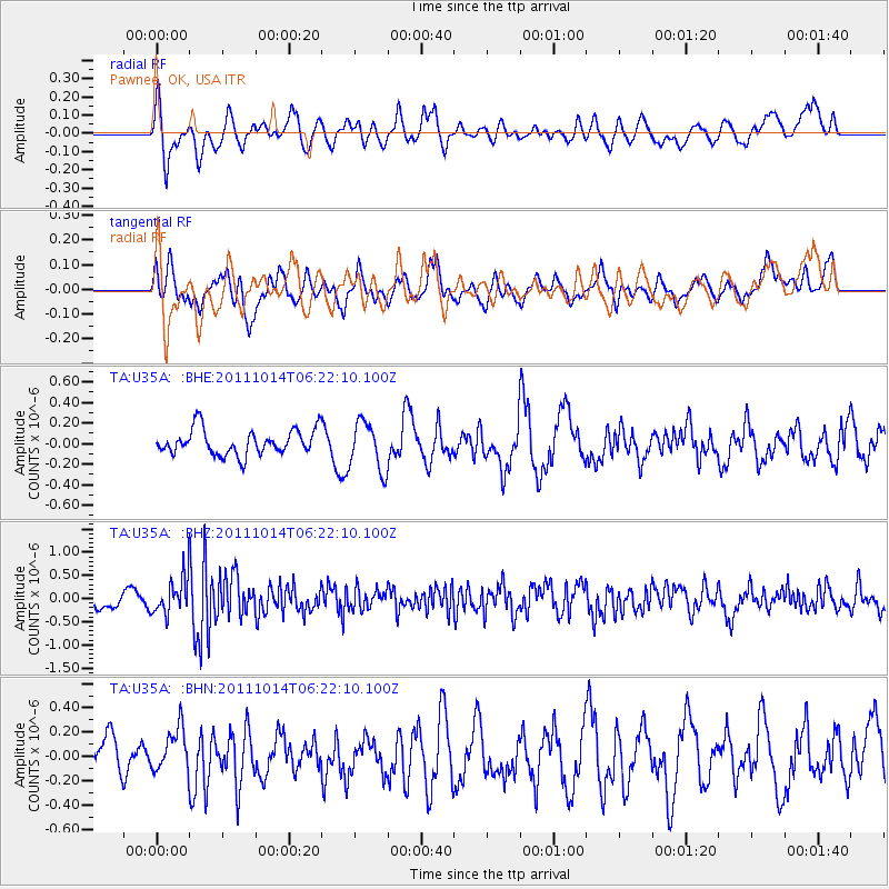
U35A Pawnee, OK, USA - Earthquake Result Viewer
*The percent match for this event was below the threshold and hence no stack was calculated.
| Earthquake location: |
Southeastern Siberia, Russia |
| Earthquake latitude/longitude: |
54.1/123.7 |
| Earthquake time(UTC): |
2011/10/14 (287) 06:10:14 GMT |
| Earthquake Depth: |
12 km |
| Earthquake Magnitude: |
5.7 MB, 5.9 MS, 6.1 MW, 6.0 MW |
| Earthquake Catalog/Contributor: |
WHDF/NEIC |
|
| Network: |
TA USArray Transportable Network (new EarthScope stations) |
| Station: |
U35A Pawnee, OK, USA |
| Lat/Lon: |
36.37 N/96.73 W |
| Elevation: |
303 m |
|
| Distance: |
83.4 deg |
| Az: |
31.815 deg |
| Baz: |
337.364 deg |
| Ray Param: |
$rayparam |
*The percent match for this event was below the threshold and hence was not used in the summary stack. |
|
| Radial Match: |
58.87427 % |
| Radial Bump: |
400 |
| Transverse Match: |
46.85832 % |
| Transverse Bump: |
357 |
| SOD ConfigId: |
424168 |
| Insert Time: |
2012-02-08 02:53:15.181 +0000 |
| GWidth: |
2.5 |
| Max Bumps: |
400 |
| Tol: |
0.001 |
|
Signal To Noise
| Channel | StoN | STA | LTA |
| TA:U35A: :BHZ:20111014T06:22:10.100Z | 3.0448177 | 3.9503985E-7 | 1.2974172E-7 |
| TA:U35A: :BHN:20111014T06:22:10.100Z | 1.1119158 | 1.8029245E-7 | 1.6214578E-7 |
| TA:U35A: :BHE:20111014T06:22:10.100Z | 1.9180449 | 2.3536856E-7 | 1.2271275E-7 |
| Arrivals |
| Ps | |
| PpPs | |
| PsPs/PpSs | |


