You are here: Home > Network List > US - United States National Seismic Network Stations List
> Station MNTX Cornudas Mountains, Texas, USA > Earthquake Result Viewer
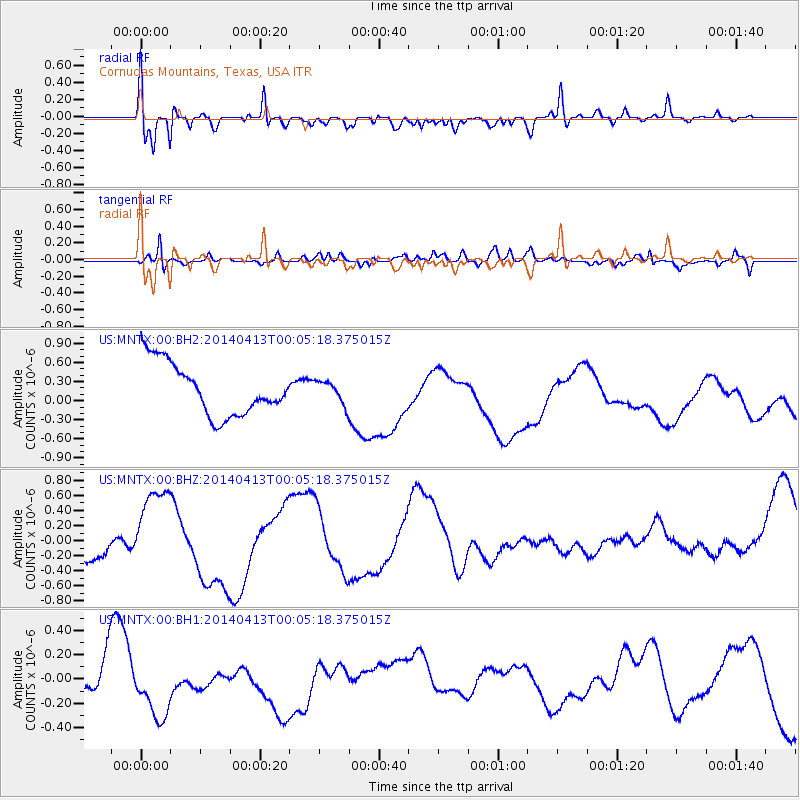
MNTX Cornudas Mountains, Texas, USA - Earthquake Result Viewer
*The percent match for this event was below the threshold and hence no stack was calculated.
| Earthquake location: |
Solomon Islands |
| Earthquake latitude/longitude: |
-11.4/162.5 |
| Earthquake time(UTC): |
2014/04/12 (102) 23:52:15 GMT |
| Earthquake Depth: |
12 km |
| Earthquake Magnitude: |
5.0 mb |
| Earthquake Catalog/Contributor: |
ISC/ISC |
|
| Network: |
US United States National Seismic Network |
| Station: |
MNTX Cornudas Mountains, Texas, USA |
| Lat/Lon: |
31.70 N/105.38 W |
| Elevation: |
404 m |
|
| Distance: |
97.6 deg |
| Az: |
59.256 deg |
| Baz: |
261.38 deg |
| Ray Param: |
$rayparam |
*The percent match for this event was below the threshold and hence was not used in the summary stack. |
|
| Radial Match: |
75.80882 % |
| Radial Bump: |
400 |
| Transverse Match: |
61.79158 % |
| Transverse Bump: |
377 |
| SOD ConfigId: |
3390531 |
| Insert Time: |
2019-04-11 08:36:10.430 +0000 |
| GWidth: |
2.5 |
| Max Bumps: |
400 |
| Tol: |
0.001 |
|
Signal To Noise
| Channel | StoN | STA | LTA |
| US:MNTX:00:BHZ:20140413T00:05:18.375015Z | 2.3699489 | 6.4009174E-7 | 2.7008673E-7 |
| US:MNTX:00:BH1:20140413T00:05:18.375015Z | 1.75151 | 3.1796074E-7 | 1.8153521E-7 |
| US:MNTX:00:BH2:20140413T00:05:18.375015Z | 0.43495044 | 1.7735047E-7 | 4.0774867E-7 |
| Arrivals |
| Ps | |
| PpPs | |
| PsPs/PpSs | |


