FDF Fort de France, Martinique France - Earthquake Result Viewer
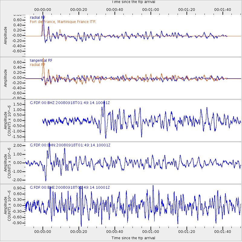
Earthquake location: Central East Pacific Rise
Earthquake latitude/longitude: -4.6/-106.0
Earthquake time(UTC): 2008/09/18 (262) 01:41:02 GMT
Earthquake Depth: 10 km
Earthquake Magnitude: 5.5 MB, 5.7 MS, 6.0 MW, 6.0 MW
Earthquake Catalog/Contributor: WHDF/NEIC
Network: G GEOSCOPE
Station: FDF Fort de France, Martinique France
Lat/Lon: 14.73 N/61.14 W
Elevation: 467 m
Distance: 48.4 deg
Az: 65.844 deg
Baz: 250.071 deg
Ray Param: 0.06938004
Estimated Moho Depth: 21.25 km
Estimated Crust Vp/Vs: 1.88
Assumed Crust Vp: 5.88 km/s
Estimated Crust Vs: 3.128 km/s
Estimated Crust Poisson's Ratio: 0.30
Radial Match: 85.3155 %
Radial Bump: 400
Transverse Match: 66.92336 %
Transverse Bump: 400
SOD ConfigId: 2504
Insert Time: 2010-02-26 22:33:21.341 +0000
GWidth: 2.5
Max Bumps: 400
Tol: 0.001

Signal To Noise

ChannelStoNSTALTA
G:FDF:00:BHN:20080918T01:49:14.10001Z10.2949671.0769135E-61.04605824E-7
G:FDF:00:BHE:20080918T01:49:14.10001Z2.04965933.6493907E-71.7804865E-7
G:FDF:00:BHZ:20080918T01:49:14.10001Z4.78948937.869114E-71.6429965E-7
Arrivals
Ps3.3 SECOND
PpPs9.9 SECOND
PsPs/PpSs13 SECOND