FDF Fort de France, Martinique France - Earthquake Result Viewer
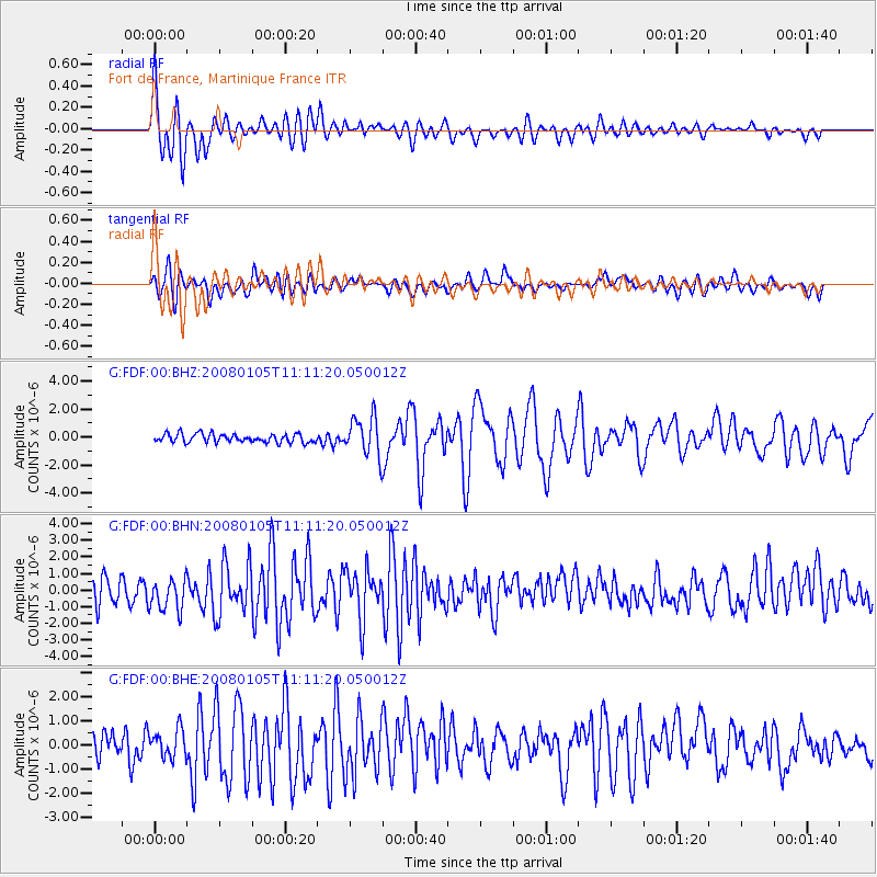
Earthquake location: Queen Charlotte Islands Region
Earthquake latitude/longitude: 51.3/-130.8
Earthquake time(UTC): 2008/01/05 (005) 11:01:05 GMT
Earthquake Depth: 10 km
Earthquake Magnitude: 6.0 MB, 6.5 MS, 6.6 MW, 6.6 MW
Earthquake Catalog/Contributor: WHDF/NEIC
Network: G GEOSCOPE
Station: FDF Fort de France, Martinique France
Lat/Lon: 14.73 N/61.14 W
Elevation: 467 m
Distance: 65.9 deg
Az: 96.507 deg
Baz: 319.816 deg
Ray Param: 0.057973344
Estimated Moho Depth: 24.5 km
Estimated Crust Vp/Vs: 1.85
Assumed Crust Vp: 5.88 km/s
Estimated Crust Vs: 3.187 km/s
Estimated Crust Poisson's Ratio: 0.29
Radial Match: 80.620964 %
Radial Bump: 400
Transverse Match: 68.73515 %
Transverse Bump: 400
SOD ConfigId: 2564
Insert Time: 2010-02-26 22:33:22.727 +0000
GWidth: 2.5
Max Bumps: 400
Tol: 0.001

Signal To Noise

ChannelStoNSTALTA
G:FDF:00:BHN:20080105T11:11:20.050012Z1.65666261.0016387E-66.0461235E-7
G:FDF:00:BHE:20080105T11:11:20.050012Z1.10995915.669467E-75.107816E-7
G:FDF:00:BHZ:20080105T11:11:20.050012Z4.51717951.396966E-63.0925625E-7
Arrivals
Ps3.6 SECOND
PpPs11 SECOND
PsPs/PpSs15 SECOND