You are here: Home > Network List > BK - Berkeley Digital Seismograph Network Stations List
> Station HUMO Hull Mountain, OR > Earthquake Result Viewer
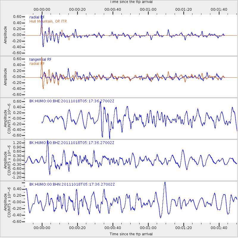
HUMO Hull Mountain, OR - Earthquake Result Viewer
*The percent match for this event was below the threshold and hence no stack was calculated.
| Earthquake location: |
New Britain Region, P.N.G. |
| Earthquake latitude/longitude: |
-5.8/151.0 |
| Earthquake time(UTC): |
2011/10/18 (291) 05:05:06 GMT |
| Earthquake Depth: |
26 km |
| Earthquake Magnitude: |
5.5 MB, 5.9 MS, 6.0 MW, 6.1 MW |
| Earthquake Catalog/Contributor: |
WHDF/NEIC |
|
| Network: |
BK Berkeley Digital Seismograph Network |
| Station: |
HUMO Hull Mountain, OR |
| Lat/Lon: |
42.61 N/122.96 W |
| Elevation: |
555 m |
|
| Distance: |
90.9 deg |
| Az: |
47.441 deg |
| Baz: |
263.069 deg |
| Ray Param: |
$rayparam |
*The percent match for this event was below the threshold and hence was not used in the summary stack. |
|
| Radial Match: |
69.570564 % |
| Radial Bump: |
400 |
| Transverse Match: |
66.4937 % |
| Transverse Bump: |
400 |
| SOD ConfigId: |
424168 |
| Insert Time: |
2012-02-10 00:34:13.078 +0000 |
| GWidth: |
2.5 |
| Max Bumps: |
400 |
| Tol: |
0.001 |
|
Signal To Noise
| Channel | StoN | STA | LTA |
| BK:HUMO:00:BHZ:20111018T05:17:36.27002Z | 3.0679555 | 5.78651E-7 | 1.8861127E-7 |
| BK:HUMO:00:BHN:20111018T05:17:36.27002Z | 0.81497985 | 1.5738267E-7 | 1.9311234E-7 |
| BK:HUMO:00:BHE:20111018T05:17:36.27002Z | 2.0094917 | 3.107283E-7 | 1.546303E-7 |
| Arrivals |
| Ps | |
| PpPs | |
| PsPs/PpSs | |


