You are here: Home > Network List > CI - Caltech Regional Seismic Network Stations List
> Station LRL Laurel Mtn Radio Fac, Ridgecrest, CA, USA > Earthquake Result Viewer
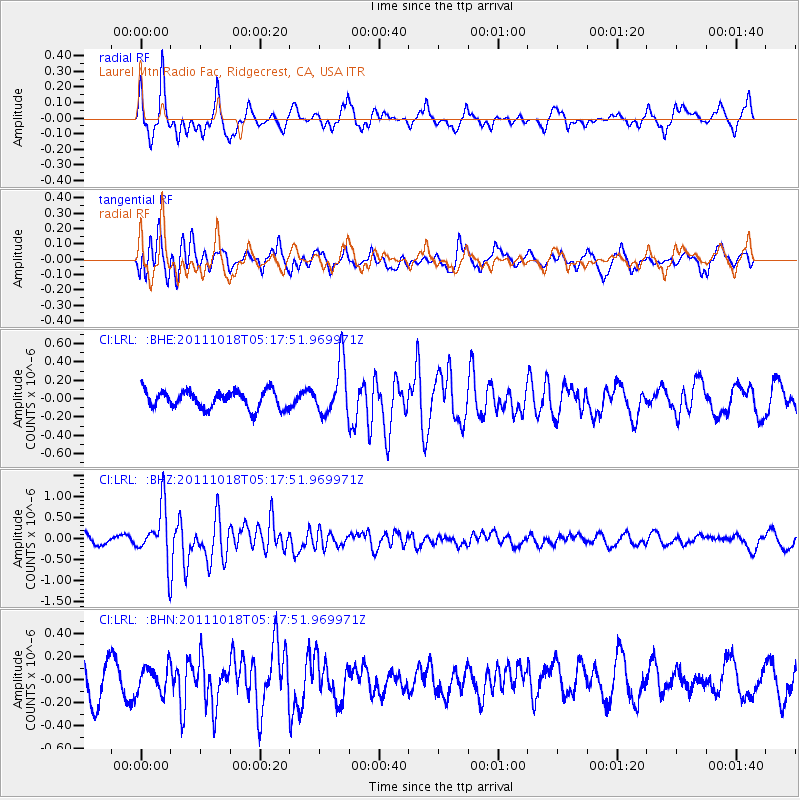
LRL Laurel Mtn Radio Fac, Ridgecrest, CA, USA - Earthquake Result Viewer
*The percent match for this event was below the threshold and hence no stack was calculated.
| Earthquake location: |
New Britain Region, P.N.G. |
| Earthquake latitude/longitude: |
-5.8/151.0 |
| Earthquake time(UTC): |
2011/10/18 (291) 05:05:06 GMT |
| Earthquake Depth: |
26 km |
| Earthquake Magnitude: |
5.5 MB, 5.9 MS, 6.0 MW, 6.1 MW |
| Earthquake Catalog/Contributor: |
WHDF/NEIC |
|
| Network: |
CI Caltech Regional Seismic Network |
| Station: |
LRL Laurel Mtn Radio Fac, Ridgecrest, CA, USA |
| Lat/Lon: |
35.48 N/117.68 W |
| Elevation: |
1340 m |
|
| Distance: |
94.4 deg |
| Az: |
54.917 deg |
| Baz: |
266.04 deg |
| Ray Param: |
$rayparam |
*The percent match for this event was below the threshold and hence was not used in the summary stack. |
|
| Radial Match: |
61.971825 % |
| Radial Bump: |
400 |
| Transverse Match: |
55.65028 % |
| Transverse Bump: |
400 |
| SOD ConfigId: |
424168 |
| Insert Time: |
2012-02-10 00:35:24.478 +0000 |
| GWidth: |
2.5 |
| Max Bumps: |
400 |
| Tol: |
0.001 |
|
Signal To Noise
| Channel | StoN | STA | LTA |
| CI:LRL: :BHZ:20111018T05:17:51.969971Z | 4.651542 | 6.291284E-7 | 1.3525158E-7 |
| CI:LRL: :BHN:20111018T05:17:51.969971Z | 0.61856604 | 1.1809636E-7 | 1.9091955E-7 |
| CI:LRL: :BHE:20111018T05:17:51.969971Z | 2.9658177 | 2.8292266E-7 | 9.539448E-8 |
| Arrivals |
| Ps | |
| PpPs | |
| PsPs/PpSs | |


