FDF Fort de France, Martinique France - Earthquake Result Viewer
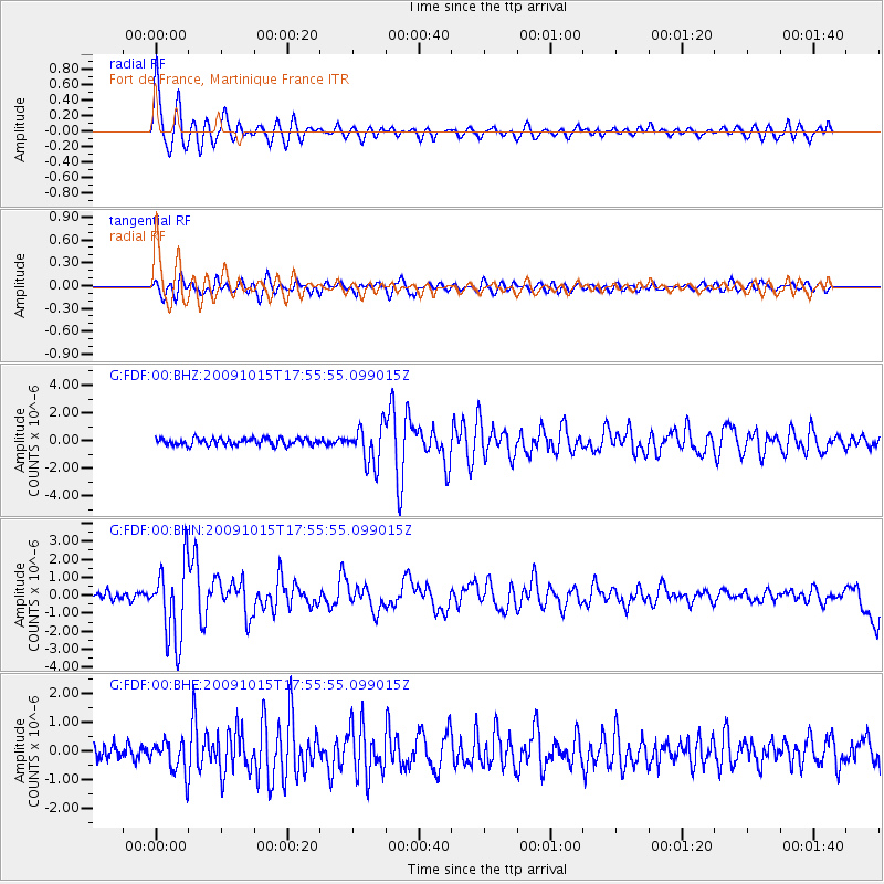
Earthquake location: Galapagos Triple Junction Region
Earthquake latitude/longitude: 3.3/-103.8
Earthquake time(UTC): 2009/10/15 (288) 17:48:21 GMT
Earthquake Depth: 10 km
Earthquake Magnitude: 5.9 MB, 5.7 MS, 6.0 MW, 6.0 MW
Earthquake Catalog/Contributor: WHDF/NEIC
Network: G GEOSCOPE
Station: FDF Fort de France, Martinique France
Lat/Lon: 14.73 N/61.14 W
Elevation: 467 m
Distance: 43.6 deg
Az: 72.086 deg
Baz: 259.073 deg
Ray Param: 0.07246388
Estimated Moho Depth: 23.0 km
Estimated Crust Vp/Vs: 1.82
Assumed Crust Vp: 5.88 km/s
Estimated Crust Vs: 3.227 km/s
Estimated Crust Poisson's Ratio: 0.28
Radial Match: 87.68105 %
Radial Bump: 400
Transverse Match: 74.83504 %
Transverse Bump: 400
SOD ConfigId: 2622
Insert Time: 2010-02-26 22:33:25.316 +0000
GWidth: 2.5
Max Bumps: 400
Tol: 0.001

Signal To Noise

ChannelStoNSTALTA
G:FDF:00:BHN:20091015T17:55:55.099015Z10.5315312.1476478E-62.039255E-7
G:FDF:00:BHE:20091015T17:55:55.099015Z1.98212346.006784E-73.0304793E-7
G:FDF:00:BHZ:20091015T17:55:55.099015Z5.48760461.3865998E-62.5267852E-7
Arrivals
Ps3.4 SECOND
PpPs10 SECOND
PsPs/PpSs14 SECOND