You are here: Home > Network List > CI - Caltech Regional Seismic Network Stations List
> Station MPP McPhearson Peak > Earthquake Result Viewer
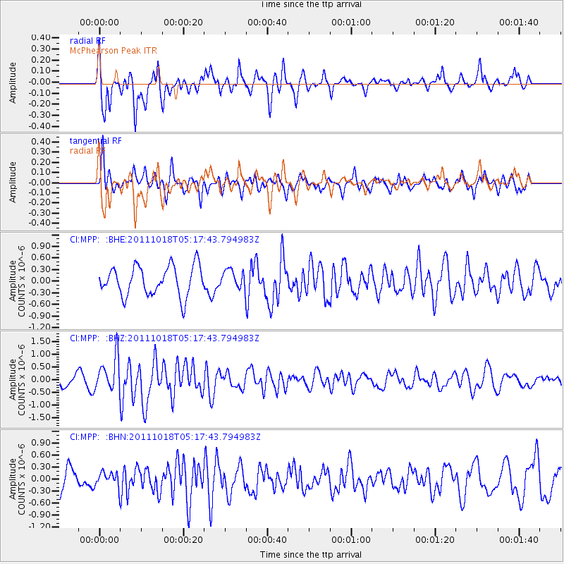
MPP McPhearson Peak - Earthquake Result Viewer
*The percent match for this event was below the threshold and hence no stack was calculated.
| Earthquake location: |
New Britain Region, P.N.G. |
| Earthquake latitude/longitude: |
-5.8/151.0 |
| Earthquake time(UTC): |
2011/10/18 (291) 05:05:06 GMT |
| Earthquake Depth: |
26 km |
| Earthquake Magnitude: |
5.5 MB, 5.9 MS, 6.0 MW, 6.1 MW |
| Earthquake Catalog/Contributor: |
WHDF/NEIC |
|
| Network: |
CI Caltech Regional Seismic Network |
| Station: |
MPP McPhearson Peak |
| Lat/Lon: |
34.89 N/119.81 W |
| Elevation: |
1739 m |
|
| Distance: |
92.6 deg |
| Az: |
55.366 deg |
| Baz: |
264.79 deg |
| Ray Param: |
$rayparam |
*The percent match for this event was below the threshold and hence was not used in the summary stack. |
|
| Radial Match: |
65.66858 % |
| Radial Bump: |
400 |
| Transverse Match: |
60.135506 % |
| Transverse Bump: |
400 |
| SOD ConfigId: |
424168 |
| Insert Time: |
2012-02-10 00:37:24.447 +0000 |
| GWidth: |
2.5 |
| Max Bumps: |
400 |
| Tol: |
0.001 |
|
Signal To Noise
| Channel | StoN | STA | LTA |
| CI:MPP: :BHZ:20111018T05:17:43.794983Z | 3.490059 | 6.849839E-7 | 1.9626715E-7 |
| CI:MPP: :BHN:20111018T05:17:43.794983Z | 0.6615203 | 1.8110887E-7 | 2.7377675E-7 |
| CI:MPP: :BHE:20111018T05:17:43.794983Z | 0.6363631 | 2.435114E-7 | 3.826611E-7 |
| Arrivals |
| Ps | |
| PpPs | |
| PsPs/PpSs | |


