You are here: Home > Network List > IW - Intermountain West Stations List
> Station PLID Pearl Lake, Idaho, USA > Earthquake Result Viewer
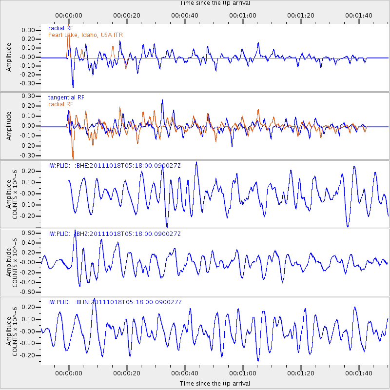
PLID Pearl Lake, Idaho, USA - Earthquake Result Viewer
*The percent match for this event was below the threshold and hence no stack was calculated.
| Earthquake location: |
New Britain Region, P.N.G. |
| Earthquake latitude/longitude: |
-5.8/151.0 |
| Earthquake time(UTC): |
2011/10/18 (291) 05:05:06 GMT |
| Earthquake Depth: |
26 km |
| Earthquake Magnitude: |
5.5 MB, 5.9 MS, 6.0 MW, 6.1 MW |
| Earthquake Catalog/Contributor: |
WHDF/NEIC |
|
| Network: |
IW Intermountain West |
| Station: |
PLID Pearl Lake, Idaho, USA |
| Lat/Lon: |
45.09 N/116.00 W |
| Elevation: |
2164 m |
|
| Distance: |
96.1 deg |
| Az: |
45.361 deg |
| Baz: |
268.004 deg |
| Ray Param: |
$rayparam |
*The percent match for this event was below the threshold and hence was not used in the summary stack. |
|
| Radial Match: |
64.284004 % |
| Radial Bump: |
400 |
| Transverse Match: |
53.000286 % |
| Transverse Bump: |
355 |
| SOD ConfigId: |
424168 |
| Insert Time: |
2012-02-10 00:40:50.725 +0000 |
| GWidth: |
2.5 |
| Max Bumps: |
400 |
| Tol: |
0.001 |
|
Signal To Noise
| Channel | StoN | STA | LTA |
| IW:PLID: :BHZ:20111018T05:18:00.090027Z | 3.0960693 | 3.0153825E-7 | 9.7393894E-8 |
| IW:PLID: :BHN:20111018T05:18:00.090027Z | 1.8230187 | 9.957909E-8 | 5.462319E-8 |
| IW:PLID: :BHE:20111018T05:18:00.090027Z | 1.5987277 | 1.4850079E-7 | 9.288686E-8 |
| Arrivals |
| Ps | |
| PpPs | |
| PsPs/PpSs | |


