You are here: Home > Network List > TA - USArray Transportable Network (new EarthScope stations) Stations List
> Station 109C Camp Elliot, Mirimar, CA, USA > Earthquake Result Viewer
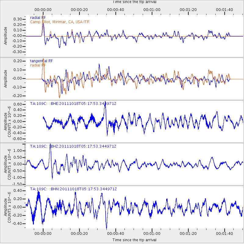
109C Camp Elliot, Mirimar, CA, USA - Earthquake Result Viewer
*The percent match for this event was below the threshold and hence no stack was calculated.
| Earthquake location: |
New Britain Region, P.N.G. |
| Earthquake latitude/longitude: |
-5.8/151.0 |
| Earthquake time(UTC): |
2011/10/18 (291) 05:05:06 GMT |
| Earthquake Depth: |
26 km |
| Earthquake Magnitude: |
5.5 MB, 5.9 MS, 6.0 MW, 6.1 MW |
| Earthquake Catalog/Contributor: |
WHDF/NEIC |
|
| Network: |
TA USArray Transportable Network (new EarthScope stations) |
| Station: |
109C Camp Elliot, Mirimar, CA, USA |
| Lat/Lon: |
32.89 N/117.11 W |
| Elevation: |
150 m |
|
| Distance: |
94.7 deg |
| Az: |
57.536 deg |
| Baz: |
266.156 deg |
| Ray Param: |
$rayparam |
*The percent match for this event was below the threshold and hence was not used in the summary stack. |
|
| Radial Match: |
68.75543 % |
| Radial Bump: |
400 |
| Transverse Match: |
44.548164 % |
| Transverse Bump: |
357 |
| SOD ConfigId: |
424168 |
| Insert Time: |
2012-02-10 00:42:33.942 +0000 |
| GWidth: |
2.5 |
| Max Bumps: |
400 |
| Tol: |
0.001 |
|
Signal To Noise
| Channel | StoN | STA | LTA |
| TA:109C: :BHZ:20111018T05:17:53.344971Z | 2.979975 | 5.69464E-7 | 1.9109692E-7 |
| TA:109C: :BHN:20111018T05:17:53.344971Z | 1.7863067 | 1.9643808E-7 | 1.0996884E-7 |
| TA:109C: :BHE:20111018T05:17:53.344971Z | 2.0188694 | 2.6205177E-7 | 1.2980126E-7 |
| Arrivals |
| Ps | |
| PpPs | |
| PsPs/PpSs | |


