You are here: Home > Network List > TA - USArray Transportable Network (new EarthScope stations) Stations List
> Station G05D Wamic, OR, USA > Earthquake Result Viewer
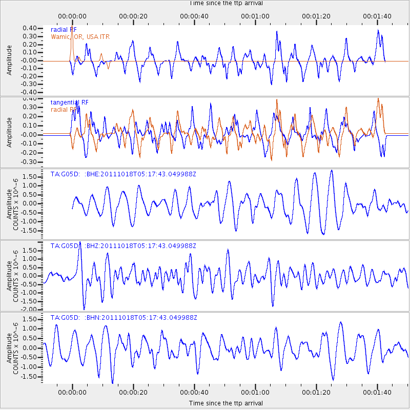
G05D Wamic, OR, USA - Earthquake Result Viewer
*The percent match for this event was below the threshold and hence no stack was calculated.
| Earthquake location: |
New Britain Region, P.N.G. |
| Earthquake latitude/longitude: |
-5.8/151.0 |
| Earthquake time(UTC): |
2011/10/18 (291) 05:05:06 GMT |
| Earthquake Depth: |
26 km |
| Earthquake Magnitude: |
5.5 MB, 5.9 MS, 6.0 MW, 6.1 MW |
| Earthquake Catalog/Contributor: |
WHDF/NEIC |
|
| Network: |
TA USArray Transportable Network (new EarthScope stations) |
| Station: |
G05D Wamic, OR, USA |
| Lat/Lon: |
45.24 N/121.32 W |
| Elevation: |
592 m |
|
| Distance: |
92.4 deg |
| Az: |
44.952 deg |
| Baz: |
264.275 deg |
| Ray Param: |
$rayparam |
*The percent match for this event was below the threshold and hence was not used in the summary stack. |
|
| Radial Match: |
56.94637 % |
| Radial Bump: |
400 |
| Transverse Match: |
62.574028 % |
| Transverse Bump: |
400 |
| SOD ConfigId: |
424168 |
| Insert Time: |
2012-02-10 00:43:13.958 +0000 |
| GWidth: |
2.5 |
| Max Bumps: |
400 |
| Tol: |
0.001 |
|
Signal To Noise
| Channel | StoN | STA | LTA |
| TA:G05D: :BHZ:20111018T05:17:43.049988Z | 2.33679 | 1.0397846E-6 | 4.4496272E-7 |
| TA:G05D: :BHN:20111018T05:17:43.049988Z | 1.0209833 | 6.0014804E-7 | 5.8781376E-7 |
| TA:G05D: :BHE:20111018T05:17:43.049988Z | 0.73785776 | 4.209217E-7 | 5.704646E-7 |
| Arrivals |
| Ps | |
| PpPs | |
| PsPs/PpSs | |


