You are here: Home > Network List > TA - USArray Transportable Network (new EarthScope stations) Stations List
> Station O03D Paynes Creek, CA, USA > Earthquake Result Viewer
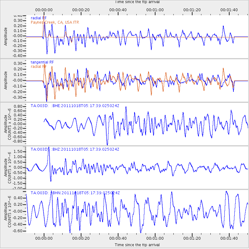
O03D Paynes Creek, CA, USA - Earthquake Result Viewer
*The percent match for this event was below the threshold and hence no stack was calculated.
| Earthquake location: |
New Britain Region, P.N.G. |
| Earthquake latitude/longitude: |
-5.8/151.0 |
| Earthquake time(UTC): |
2011/10/18 (291) 05:05:06 GMT |
| Earthquake Depth: |
26 km |
| Earthquake Magnitude: |
5.5 MB, 5.9 MS, 6.0 MW, 6.1 MW |
| Earthquake Catalog/Contributor: |
WHDF/NEIC |
|
| Network: |
TA USArray Transportable Network (new EarthScope stations) |
| Station: |
O03D Paynes Creek, CA, USA |
| Lat/Lon: |
40.29 N/121.80 W |
| Elevation: |
968 m |
|
| Distance: |
91.5 deg |
| Az: |
49.836 deg |
| Baz: |
263.779 deg |
| Ray Param: |
$rayparam |
*The percent match for this event was below the threshold and hence was not used in the summary stack. |
|
| Radial Match: |
79.59987 % |
| Radial Bump: |
400 |
| Transverse Match: |
65.410774 % |
| Transverse Bump: |
350 |
| SOD ConfigId: |
424168 |
| Insert Time: |
2012-02-10 00:43:43.239 +0000 |
| GWidth: |
2.5 |
| Max Bumps: |
400 |
| Tol: |
0.001 |
|
Signal To Noise
| Channel | StoN | STA | LTA |
| TA:O03D: :BHZ:20111018T05:17:39.025024Z | 4.8464074 | 8.0036824E-7 | 1.651467E-7 |
| TA:O03D: :BHN:20111018T05:17:39.025024Z | 1.4713291 | 3.3406363E-7 | 2.2704889E-7 |
| TA:O03D: :BHE:20111018T05:17:39.025024Z | 2.559813 | 4.1866284E-7 | 1.6355212E-7 |
| Arrivals |
| Ps | |
| PpPs | |
| PsPs/PpSs | |


