FDF Fort de France, Martinique France - Earthquake Result Viewer
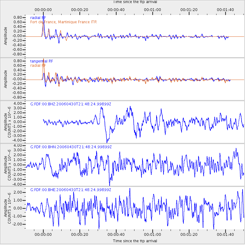
Earthquake location: Near Coast Of Northern Chile
Earthquake latitude/longitude: -27.2/-71.1
Earthquake time(UTC): 2006/04/30 (120) 21:40:58 GMT
Earthquake Depth: 12 km
Earthquake Magnitude: 5.9 MB, 6.7 MS, 6.5 MW, 6.3 ML
Earthquake Catalog/Contributor: WHDF/NEIC
Network: G GEOSCOPE
Station: FDF Fort de France, Martinique France
Lat/Lon: 14.73 N/61.14 W
Elevation: 467 m
Distance: 42.8 deg
Az: 14.193 deg
Baz: 193.043 deg
Ray Param: 0.072957605
Estimated Moho Depth: 60.75 km
Estimated Crust Vp/Vs: 1.88
Assumed Crust Vp: 5.88 km/s
Estimated Crust Vs: 3.12 km/s
Estimated Crust Poisson's Ratio: 0.30
Radial Match: 80.96403 %
Radial Bump: 400
Transverse Match: 65.74055 %
Transverse Bump: 400
SOD ConfigId: 2669
Insert Time: 2010-02-26 22:33:30.976 +0000
GWidth: 2.5
Max Bumps: 400
Tol: 0.001

Signal To Noise

ChannelStoNSTALTA
G:FDF:00:BHN:20060430T21:48:24.99899Z3.41203571.3645127E-63.999116E-7
G:FDF:00:BHE:20060430T21:48:24.99899Z1.8379336.608138E-73.5954184E-7
G:FDF:00:BHZ:20060430T21:48:24.99899Z6.82050471.8793907E-62.7555006E-7
Arrivals
Ps9.6 SECOND
PpPs28 SECOND
PsPs/PpSs38 SECOND