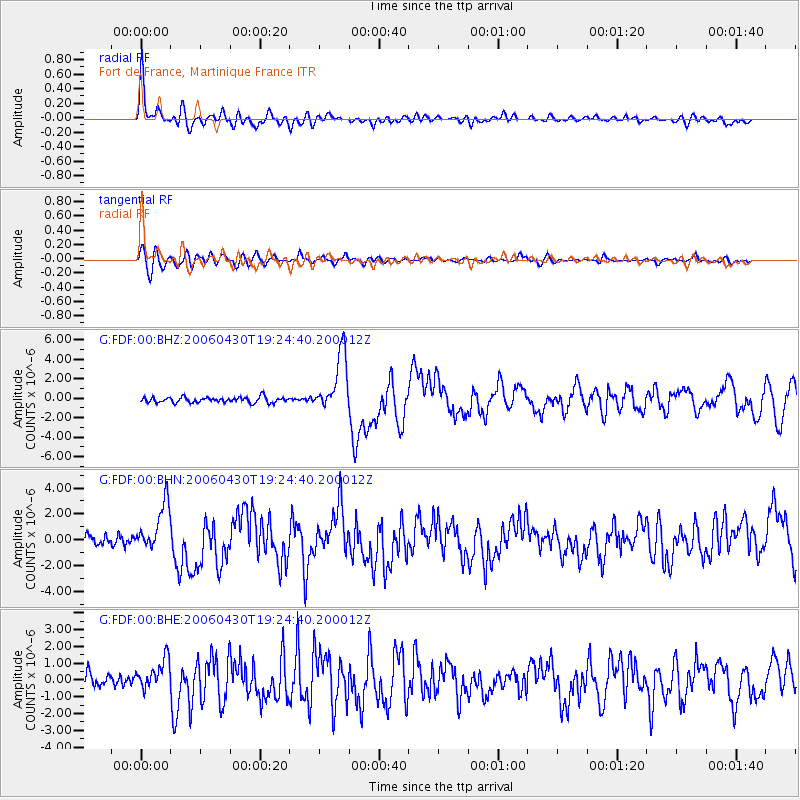
FDF Fort de France, Martinique France - Earthquake Result Viewer
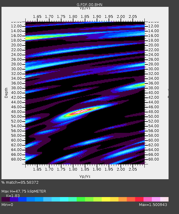
Earthquake location: Near Coast Of Northern Chile
Earthquake latitude/longitude: -27.0/-71.0
Earthquake time(UTC): 2006/04/30 (120) 19:17:17 GMT
Earthquake Depth: 27 km
Earthquake Magnitude: 6.0 MB, 6.4 MS, 6.7 MW, 6.6 MW
Earthquake Catalog/Contributor: WHDF/NEIC
Network: G GEOSCOPE
Station: FDF Fort de France, Martinique France
Lat/Lon: 14.73 N/61.14 W
Elevation: 467 m
Distance: 42.6 deg
Az: 14.11 deg
Baz: 192.99 deg
Ray Param: 0.0730489
Estimated Moho Depth: 47.75 km
Estimated Crust Vp/Vs: 1.83
Assumed Crust Vp: 5.88 km/s
Estimated Crust Vs: 3.213 km/s
Estimated Crust Poisson's Ratio: 0.29
Radial Match: 85.58372 %
Radial Bump: 400
Transverse Match: 69.5682 %
Transverse Bump: 400
SOD ConfigId: 2669
Insert Time: 2010-02-26 22:33:32.390 +0000
GWidth: 2.5
Max Bumps: 400
Tol: 0.001

Signal To Noise

ChannelStoNSTALTA
G:FDF:00:BHN:20060430T19:24:40.200012Z4.3872571.869522E-64.261255E-7
G:FDF:00:BHE:20060430T19:24:40.200012Z2.42960029.1485924E-73.765472E-7
G:FDF:00:BHZ:20060430T19:24:40.200012Z10.6008852.961725E-62.7938466E-7
Arrivals
Ps7.1 SECOND
PpPs22 SECOND
PsPs/PpSs29 SECOND