You are here: Home > Network List > US - United States National Seismic Network Stations List
> Station MSO Missoula, Montana, USA > Earthquake Result Viewer
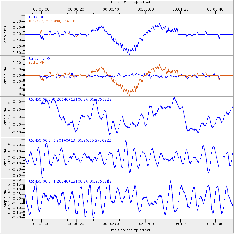
MSO Missoula, Montana, USA - Earthquake Result Viewer
*The percent match for this event was below the threshold and hence no stack was calculated.
| Earthquake location: |
Solomon Islands |
| Earthquake latitude/longitude: |
-6.8/155.1 |
| Earthquake time(UTC): |
2014/04/13 (103) 06:13:13 GMT |
| Earthquake Depth: |
10 km |
| Earthquake Magnitude: |
4.7 mb |
| Earthquake Catalog/Contributor: |
ISC/ISC |
|
| Network: |
US United States National Seismic Network |
| Station: |
MSO Missoula, Montana, USA |
| Lat/Lon: |
46.83 N/113.94 W |
| Elevation: |
1264 m |
|
| Distance: |
95.6 deg |
| Az: |
43.612 deg |
| Baz: |
266.074 deg |
| Ray Param: |
$rayparam |
*The percent match for this event was below the threshold and hence was not used in the summary stack. |
|
| Radial Match: |
41.85208 % |
| Radial Bump: |
400 |
| Transverse Match: |
47.376457 % |
| Transverse Bump: |
400 |
| SOD ConfigId: |
3390531 |
| Insert Time: |
2019-04-11 08:44:21.373 +0000 |
| GWidth: |
2.5 |
| Max Bumps: |
400 |
| Tol: |
0.001 |
|
Signal To Noise
| Channel | StoN | STA | LTA |
| US:MSO:00:BHZ:20140413T06:26:06.975022Z | 3.508355 | 1.8755823E-7 | 5.346045E-8 |
| US:MSO:00:BH1:20140413T06:26:06.975022Z | 0.6657795 | 5.7007E-8 | 8.562445E-8 |
| US:MSO:00:BH2:20140413T06:26:06.975022Z | 0.8526019 | 2.2531373E-7 | 2.6426605E-7 |
| Arrivals |
| Ps | |
| PpPs | |
| PsPs/PpSs | |


