You are here: Home > Network List > UW - Pacific Northwest Regional Seismic Network Stations List
> Station UMAT Pilot Rock, OR, USA > Earthquake Result Viewer
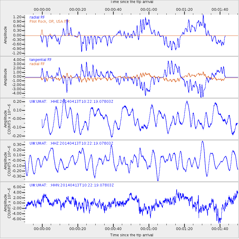
UMAT Pilot Rock, OR, USA - Earthquake Result Viewer
*The percent match for this event was below the threshold and hence no stack was calculated.
| Earthquake location: |
Solomon Islands |
| Earthquake latitude/longitude: |
-11.2/162.0 |
| Earthquake time(UTC): |
2014/04/13 (103) 10:09:49 GMT |
| Earthquake Depth: |
10 km |
| Earthquake Magnitude: |
5.6 MW |
| Earthquake Catalog/Contributor: |
ISC/ISC |
|
| Network: |
UW Pacific Northwest Regional Seismic Network |
| Station: |
UMAT Pilot Rock, OR, USA |
| Lat/Lon: |
45.29 N/118.96 W |
| Elevation: |
1318 m |
|
| Distance: |
90.3 deg |
| Az: |
43.866 deg |
| Baz: |
254.385 deg |
| Ray Param: |
$rayparam |
*The percent match for this event was below the threshold and hence was not used in the summary stack. |
|
| Radial Match: |
38.0162 % |
| Radial Bump: |
400 |
| Transverse Match: |
34.941578 % |
| Transverse Bump: |
400 |
| SOD ConfigId: |
3390531 |
| Insert Time: |
2019-04-11 08:57:09.333 +0000 |
| GWidth: |
2.5 |
| Max Bumps: |
400 |
| Tol: |
0.001 |
|
Signal To Noise
| Channel | StoN | STA | LTA |
| UW:UMAT: :HHZ:20140413T10:22:19.07803Z | 0.7185327 | 1.0259163E-7 | 1.4277934E-7 |
| UW:UMAT: :HHN:20140413T10:22:19.07803Z | 1.9648727 | 2.8207937E-6 | 1.4356115E-6 |
| UW:UMAT: :HHE:20140413T10:22:19.07803Z | 0.80791676 | 8.551262E-8 | 1.05843355E-7 |
| Arrivals |
| Ps | |
| PpPs | |
| PsPs/PpSs | |


