You are here: Home > Network List > G - GEOSCOPE Stations List
> Station FDF Fort de France, Martinique France > Earthquake Result Viewer
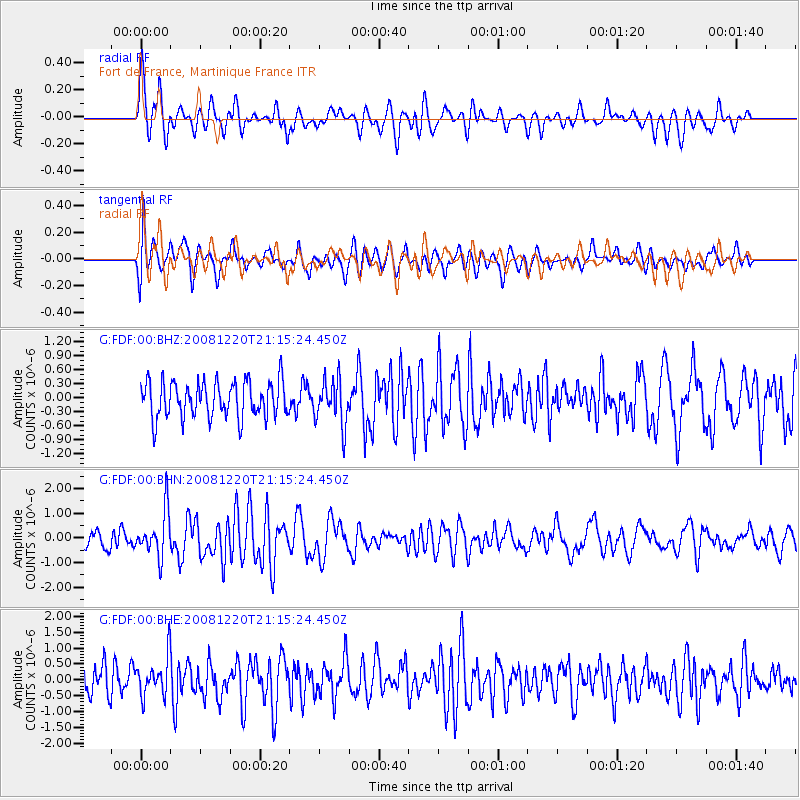
FDF Fort de France, Martinique France - Earthquake Result Viewer
*The percent match for this event was below the threshold and hence no stack was calculated.
| Earthquake location: |
Southern Mid-Atlantic Ridge |
| Earthquake latitude/longitude: |
-31.2/-13.3 |
| Earthquake time(UTC): |
2008/12/20 (355) 21:05:16 GMT |
| Earthquake Depth: |
4.0 km |
| Earthquake Magnitude: |
5.8 MB, 5.6 MS, 5.8 MW, 5.8 MW |
| Earthquake Catalog/Contributor: |
WHDF/NEIC |
|
| Network: |
G GEOSCOPE |
| Station: |
FDF Fort de France, Martinique France |
| Lat/Lon: |
14.73 N/61.14 W |
| Elevation: |
467 m |
|
| Distance: |
64.7 deg |
| Az: |
307.575 deg |
| Baz: |
135.414 deg |
| Ray Param: |
$rayparam |
*The percent match for this event was below the threshold and hence was not used in the summary stack. |
|
| Radial Match: |
65.465744 % |
| Radial Bump: |
400 |
| Transverse Match: |
58.114506 % |
| Transverse Bump: |
400 |
| SOD ConfigId: |
2658 |
| Insert Time: |
2010-02-26 22:34:48.280 +0000 |
| GWidth: |
2.5 |
| Max Bumps: |
400 |
| Tol: |
0.001 |
|
Signal To Noise
| Channel | StoN | STA | LTA |
| G:FDF:00:BHN:20081220T21:15:24.450Z | 3.9556735 | 9.179573E-7 | 2.3206094E-7 |
| G:FDF:00:BHE:20081220T21:15:24.450Z | 1.3554469 | 6.269254E-7 | 4.62523E-7 |
| G:FDF:00:BHZ:20081220T21:15:24.450Z | 1.2472138 | 4.8049577E-7 | 3.8525533E-7 |
| Arrivals |
| Ps | |
| PpPs | |
| PsPs/PpSs | |


