You are here: Home > Network List > TA - USArray Transportable Network (new EarthScope stations) Stations List
> Station I36A Fitzsimmons Farm, Good Thunder, MN, USA > Earthquake Result Viewer
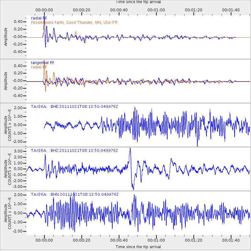
I36A Fitzsimmons Farm, Good Thunder, MN, USA - Earthquake Result Viewer
*The percent match for this event was below the threshold and hence no stack was calculated.
| Earthquake location: |
Hokkaido, Japan Region |
| Earthquake latitude/longitude: |
43.9/142.5 |
| Earthquake time(UTC): |
2011/10/21 (294) 08:02:37 GMT |
| Earthquake Depth: |
187 km |
| Earthquake Magnitude: |
5.9 MB, 6.1 MW, 6.1 MW |
| Earthquake Catalog/Contributor: |
WHDF/NEIC |
|
| Network: |
TA USArray Transportable Network (new EarthScope stations) |
| Station: |
I36A Fitzsimmons Farm, Good Thunder, MN, USA |
| Lat/Lon: |
44.02 N/94.01 W |
| Elevation: |
307 m |
|
| Distance: |
79.0 deg |
| Az: |
37.79 deg |
| Baz: |
322.115 deg |
| Ray Param: |
$rayparam |
*The percent match for this event was below the threshold and hence was not used in the summary stack. |
|
| Radial Match: |
65.89156 % |
| Radial Bump: |
400 |
| Transverse Match: |
47.01681 % |
| Transverse Bump: |
400 |
| SOD ConfigId: |
424168 |
| Insert Time: |
2012-02-10 01:34:52.030 +0000 |
| GWidth: |
2.5 |
| Max Bumps: |
400 |
| Tol: |
0.001 |
|
Signal To Noise
| Channel | StoN | STA | LTA |
| TA:I36A: :BHZ:20111021T08:13:50.049976Z | 4.006481 | 9.605283E-7 | 2.397436E-7 |
| TA:I36A: :BHN:20111021T08:13:50.049976Z | 2.7845917 | 6.155107E-7 | 2.2104163E-7 |
| TA:I36A: :BHE:20111021T08:13:50.049976Z | 1.8500284 | 4.512426E-7 | 2.439112E-7 |
| Arrivals |
| Ps | |
| PpPs | |
| PsPs/PpSs | |


