You are here: Home > Network List > TA - USArray Transportable Network (new EarthScope stations) Stations List
> Station G33A Ortonville, MN, USA > Earthquake Result Viewer
G33A Ortonville, MN, USA - Earthquake Result Viewer

| Earthquake location: |
Hokkaido, Japan Region |
| Earthquake latitude/longitude: |
43.9/142.5 |
| Earthquake time(UTC): |
2011/10/21 (294) 08:02:37 GMT |
| Earthquake Depth: |
187 km |
| Earthquake Magnitude: |
5.9 MB, 6.1 MW, 6.1 MW |
| Earthquake Catalog/Contributor: |
WHDF/NEIC |
|
| Network: |
TA USArray Transportable Network (new EarthScope stations) |
| Station: |
G33A Ortonville, MN, USA |
| Lat/Lon: |
45.19 N/96.44 W |
| Elevation: |
338 m |
|
| Distance: |
77.0 deg |
| Az: |
38.421 deg |
| Baz: |
320.55 deg |
| Ray Param: |
0.050127875 |
| Estimated Moho Depth: |
38.75 km |
| Estimated Crust Vp/Vs: |
1.79 |
| Assumed Crust Vp: |
6.552 km/s |
| Estimated Crust Vs: |
3.666 km/s |
| Estimated Crust Poisson's Ratio: |
0.27 |
|
| Radial Match: |
89.38898 % |
| Radial Bump: |
329 |
| Transverse Match: |
73.68091 % |
| Transverse Bump: |
400 |
| SOD ConfigId: |
424168 |
| Insert Time: |
2012-02-10 01:35:33.632 +0000 |
| GWidth: |
2.5 |
| Max Bumps: |
400 |
| Tol: |
0.001 |
|
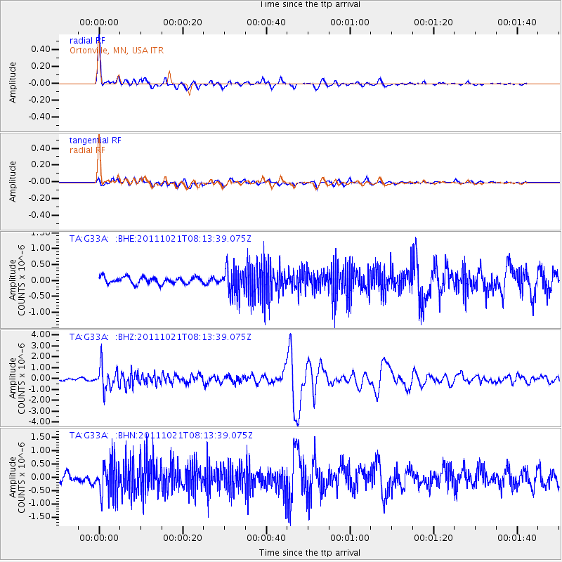
Signal To Noise
| Channel | StoN | STA | LTA |
| TA:G33A: :BHZ:20111021T08:13:39.075Z | 9.957379 | 1.0530504E-6 | 1.05755774E-7 |
| TA:G33A: :BHN:20111021T08:13:39.075Z | 5.0664954 | 6.413604E-7 | 1.2658856E-7 |
| TA:G33A: :BHE:20111021T08:13:39.075Z | 4.1164527 | 4.215872E-7 | 1.0241517E-7 |
| Arrivals |
| Ps | 4.8 SECOND |
| PpPs | 16 SECOND |
| PsPs/PpSs | 21 SECOND |


