You are here: Home > Network List > TA - USArray Transportable Network (new EarthScope stations) Stations List
> Station C34A RKJ Ranch, Bemidji, MN, USA > Earthquake Result Viewer
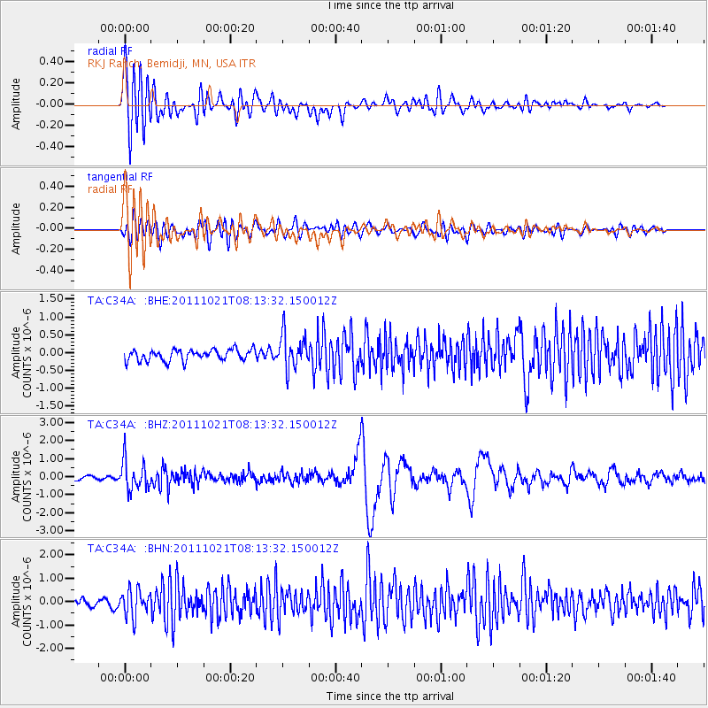
C34A RKJ Ranch, Bemidji, MN, USA - Earthquake Result Viewer
*The percent match for this event was below the threshold and hence no stack was calculated.
| Earthquake location: |
Hokkaido, Japan Region |
| Earthquake latitude/longitude: |
43.9/142.5 |
| Earthquake time(UTC): |
2011/10/21 (294) 08:02:37 GMT |
| Earthquake Depth: |
187 km |
| Earthquake Magnitude: |
5.9 MB, 6.1 MW, 6.1 MW |
| Earthquake Catalog/Contributor: |
WHDF/NEIC |
|
| Network: |
TA USArray Transportable Network (new EarthScope stations) |
| Station: |
C34A RKJ Ranch, Bemidji, MN, USA |
| Lat/Lon: |
47.65 N/94.91 W |
| Elevation: |
441 m |
|
| Distance: |
75.8 deg |
| Az: |
35.982 deg |
| Baz: |
321.08 deg |
| Ray Param: |
$rayparam |
*The percent match for this event was below the threshold and hence was not used in the summary stack. |
|
| Radial Match: |
76.43321 % |
| Radial Bump: |
400 |
| Transverse Match: |
56.6334 % |
| Transverse Bump: |
400 |
| SOD ConfigId: |
424168 |
| Insert Time: |
2012-02-10 01:36:45.215 +0000 |
| GWidth: |
2.5 |
| Max Bumps: |
400 |
| Tol: |
0.001 |
|
Signal To Noise
| Channel | StoN | STA | LTA |
| TA:C34A: :BHZ:20111021T08:13:32.150012Z | 8.69774 | 8.1819724E-7 | 9.40701E-8 |
| TA:C34A: :BHN:20111021T08:13:32.150012Z | 2.6267998 | 5.7841777E-7 | 2.2019864E-7 |
| TA:C34A: :BHE:20111021T08:13:32.150012Z | 3.111682 | 4.8387466E-7 | 1.5550262E-7 |
| Arrivals |
| Ps | |
| PpPs | |
| PsPs/PpSs | |


