You are here: Home > Network List > TA - USArray Transportable Network (new EarthScope stations) Stations List
> Station 146A Union, MS, USA > Earthquake Result Viewer
146A Union, MS, USA - Earthquake Result Viewer
*The percent match for this event was below the threshold and hence no stack was calculated.
| Earthquake location: |
Hokkaido, Japan Region |
| Earthquake latitude/longitude: |
43.9/142.5 |
| Earthquake time(UTC): |
2011/10/21 (294) 08:02:37 GMT |
| Earthquake Depth: |
187 km |
| Earthquake Magnitude: |
5.9 MB, 6.1 MW, 6.1 MW |
| Earthquake Catalog/Contributor: |
WHDF/NEIC |
|
| Network: |
TA USArray Transportable Network (new EarthScope stations) |
| Station: |
146A Union, MS, USA |
| Lat/Lon: |
32.64 N/89.06 W |
| Elevation: |
164 m |
|
| Distance: |
90.5 deg |
| Az: |
41.352 deg |
| Baz: |
325.521 deg |
| Ray Param: |
$rayparam |
*The percent match for this event was below the threshold and hence was not used in the summary stack. |
|
| Radial Match: |
74.49602 % |
| Radial Bump: |
355 |
| Transverse Match: |
67.500916 % |
| Transverse Bump: |
400 |
| SOD ConfigId: |
424168 |
| Insert Time: |
2012-02-10 01:42:50.923 +0000 |
| GWidth: |
2.5 |
| Max Bumps: |
400 |
| Tol: |
0.001 |
|
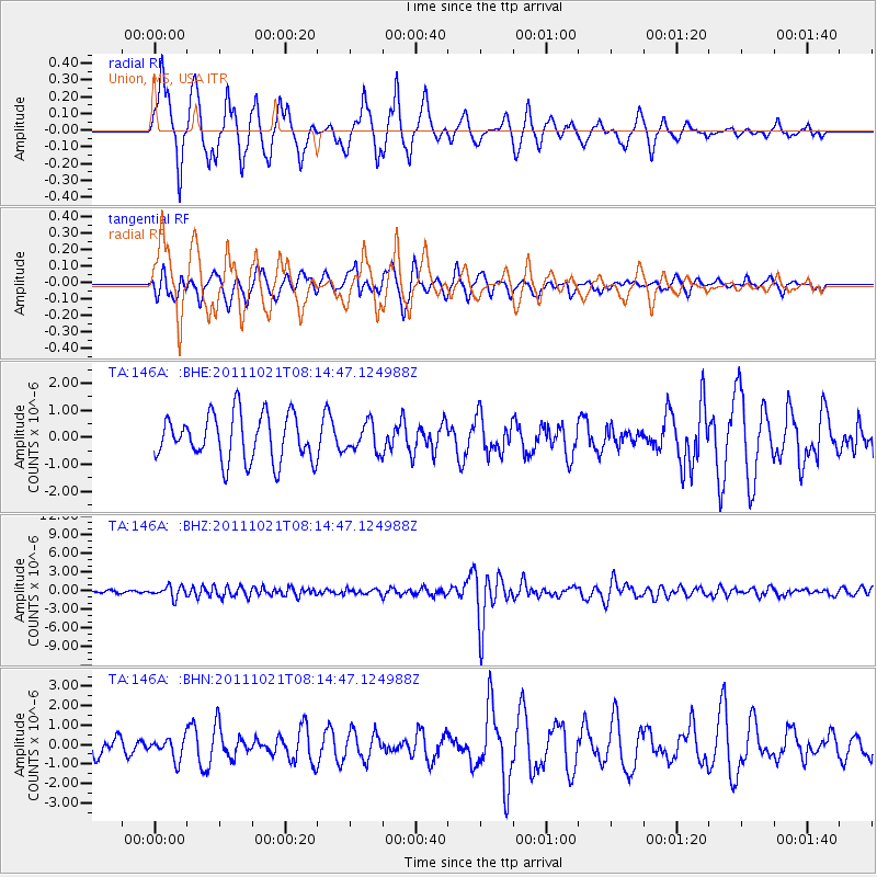
Signal To Noise
| Channel | StoN | STA | LTA |
| TA:146A: :BHZ:20111021T08:14:47.124988Z | 3.3653915 | 9.0449953E-7 | 2.68765E-7 |
| TA:146A: :BHN:20111021T08:14:47.124988Z | 0.89828837 | 5.440476E-7 | 6.056492E-7 |
| TA:146A: :BHE:20111021T08:14:47.124988Z | 0.6132633 | 5.211854E-7 | 8.4985584E-7 |
| Arrivals |
| Ps | |
| PpPs | |
| PsPs/PpSs | |


