You are here: Home > Network List > TA - USArray Transportable Network (new EarthScope stations) Stations List
> Station W45A Hickory Valley, TN, USA > Earthquake Result Viewer
W45A Hickory Valley, TN, USA - Earthquake Result Viewer
*The percent match for this event was below the threshold and hence no stack was calculated.
| Earthquake location: |
Hokkaido, Japan Region |
| Earthquake latitude/longitude: |
43.9/142.5 |
| Earthquake time(UTC): |
2011/10/21 (294) 08:02:37 GMT |
| Earthquake Depth: |
187 km |
| Earthquake Magnitude: |
5.9 MB, 6.1 MW, 6.1 MW |
| Earthquake Catalog/Contributor: |
WHDF/NEIC |
|
| Network: |
TA USArray Transportable Network (new EarthScope stations) |
| Station: |
W45A Hickory Valley, TN, USA |
| Lat/Lon: |
35.16 N/89.19 W |
| Elevation: |
187 m |
|
| Distance: |
88.4 deg |
| Az: |
40.015 deg |
| Baz: |
325.436 deg |
| Ray Param: |
$rayparam |
*The percent match for this event was below the threshold and hence was not used in the summary stack. |
|
| Radial Match: |
66.24027 % |
| Radial Bump: |
368 |
| Transverse Match: |
51.05196 % |
| Transverse Bump: |
400 |
| SOD ConfigId: |
424168 |
| Insert Time: |
2012-02-10 01:45:56.991 +0000 |
| GWidth: |
2.5 |
| Max Bumps: |
400 |
| Tol: |
0.001 |
|
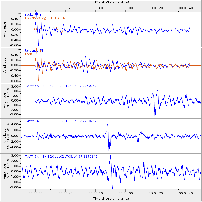
Signal To Noise
| Channel | StoN | STA | LTA |
| TA:W45A: :BHZ:20111021T08:14:37.225024Z | 3.042287 | 5.2669276E-7 | 1.7312394E-7 |
| TA:W45A: :BHN:20111021T08:14:37.225024Z | 0.6387575 | 4.77245E-7 | 7.471458E-7 |
| TA:W45A: :BHE:20111021T08:14:37.225024Z | 1.2883005 | 4.1089126E-7 | 3.1894052E-7 |
| Arrivals |
| Ps | |
| PpPs | |
| PsPs/PpSs | |


