You are here: Home > Network List > TA - USArray Transportable Network (new EarthScope stations) Stations List
> Station O42A Bath, IL, USA > Earthquake Result Viewer
O42A Bath, IL, USA - Earthquake Result Viewer

| Earthquake location: |
Hokkaido, Japan Region |
| Earthquake latitude/longitude: |
43.9/142.5 |
| Earthquake time(UTC): |
2011/10/21 (294) 08:02:37 GMT |
| Earthquake Depth: |
187 km |
| Earthquake Magnitude: |
5.9 MB, 6.1 MW, 6.1 MW |
| Earthquake Catalog/Contributor: |
WHDF/NEIC |
|
| Network: |
TA USArray Transportable Network (new EarthScope stations) |
| Station: |
O42A Bath, IL, USA |
| Lat/Lon: |
40.20 N/90.08 W |
| Elevation: |
155 m |
|
| Distance: |
83.8 deg |
| Az: |
37.714 deg |
| Baz: |
324.734 deg |
| Ray Param: |
0.04546874 |
| Estimated Moho Depth: |
33.25 km |
| Estimated Crust Vp/Vs: |
2.00 |
| Assumed Crust Vp: |
6.498 km/s |
| Estimated Crust Vs: |
3.249 km/s |
| Estimated Crust Poisson's Ratio: |
0.33 |
|
| Radial Match: |
80.7297 % |
| Radial Bump: |
400 |
| Transverse Match: |
64.95953 % |
| Transverse Bump: |
400 |
| SOD ConfigId: |
424168 |
| Insert Time: |
2012-02-10 01:47:33.880 +0000 |
| GWidth: |
2.5 |
| Max Bumps: |
400 |
| Tol: |
0.001 |
|
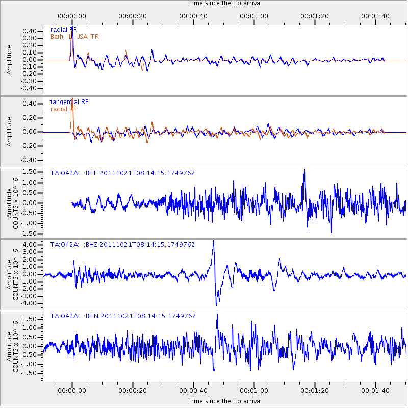
Signal To Noise
| Channel | StoN | STA | LTA |
| TA:O42A: :BHZ:20111021T08:14:15.174976Z | 3.5522614 | 7.2869614E-7 | 2.0513585E-7 |
| TA:O42A: :BHN:20111021T08:14:15.174976Z | 1.6428728 | 2.9580406E-7 | 1.8005294E-7 |
| TA:O42A: :BHE:20111021T08:14:15.174976Z | 1.3160169 | 2.5396236E-7 | 1.9297804E-7 |
| Arrivals |
| Ps | 5.2 SECOND |
| PpPs | 15 SECOND |
| PsPs/PpSs | 20 SECOND |


