You are here: Home > Network List > TA - USArray Transportable Network (new EarthScope stations) Stations List
> Station U41A Viola, AR, USA > Earthquake Result Viewer
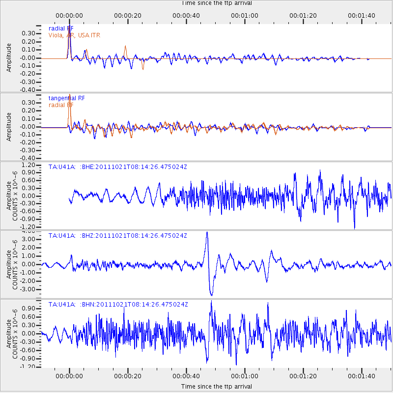
U41A Viola, AR, USA - Earthquake Result Viewer
*The percent match for this event was below the threshold and hence no stack was calculated.
| Earthquake location: |
Hokkaido, Japan Region |
| Earthquake latitude/longitude: |
43.9/142.5 |
| Earthquake time(UTC): |
2011/10/21 (294) 08:02:37 GMT |
| Earthquake Depth: |
187 km |
| Earthquake Magnitude: |
5.9 MB, 6.1 MW, 6.1 MW |
| Earthquake Catalog/Contributor: |
WHDF/NEIC |
|
| Network: |
TA USArray Transportable Network (new EarthScope stations) |
| Station: |
U41A Viola, AR, USA |
| Lat/Lon: |
36.34 N/91.92 W |
| Elevation: |
300 m |
|
| Distance: |
86.1 deg |
| Az: |
41.146 deg |
| Baz: |
323.9 deg |
| Ray Param: |
$rayparam |
*The percent match for this event was below the threshold and hence was not used in the summary stack. |
|
| Radial Match: |
79.26933 % |
| Radial Bump: |
400 |
| Transverse Match: |
75.35272 % |
| Transverse Bump: |
400 |
| SOD ConfigId: |
424168 |
| Insert Time: |
2012-02-10 01:48:43.019 +0000 |
| GWidth: |
2.5 |
| Max Bumps: |
400 |
| Tol: |
0.001 |
|
Signal To Noise
| Channel | StoN | STA | LTA |
| TA:U41A: :BHZ:20111021T08:14:26.475024Z | 3.5935693 | 4.5580032E-7 | 1.2683778E-7 |
| TA:U41A: :BHN:20111021T08:14:26.475024Z | 1.7360196 | 1.8424095E-7 | 1.0612838E-7 |
| TA:U41A: :BHE:20111021T08:14:26.475024Z | 1.6290882 | 2.3048841E-7 | 1.4148307E-7 |
| Arrivals |
| Ps | |
| PpPs | |
| PsPs/PpSs | |


