You are here: Home > Network List > TA - USArray Transportable Network (new EarthScope stations) Stations List
> Station U44A Portageville, MO, USA > Earthquake Result Viewer
U44A Portageville, MO, USA - Earthquake Result Viewer
*The percent match for this event was below the threshold and hence no stack was calculated.
| Earthquake location: |
Hokkaido, Japan Region |
| Earthquake latitude/longitude: |
43.9/142.5 |
| Earthquake time(UTC): |
2011/10/21 (294) 08:02:37 GMT |
| Earthquake Depth: |
187 km |
| Earthquake Magnitude: |
5.9 MB, 6.1 MW, 6.1 MW |
| Earthquake Catalog/Contributor: |
WHDF/NEIC |
|
| Network: |
TA USArray Transportable Network (new EarthScope stations) |
| Station: |
U44A Portageville, MO, USA |
| Lat/Lon: |
36.50 N/89.69 W |
| Elevation: |
89 m |
|
| Distance: |
87.0 deg |
| Az: |
39.583 deg |
| Baz: |
325.127 deg |
| Ray Param: |
$rayparam |
*The percent match for this event was below the threshold and hence was not used in the summary stack. |
|
| Radial Match: |
78.55939 % |
| Radial Bump: |
397 |
| Transverse Match: |
65.57127 % |
| Transverse Bump: |
400 |
| SOD ConfigId: |
424168 |
| Insert Time: |
2012-02-10 01:49:42.395 +0000 |
| GWidth: |
2.5 |
| Max Bumps: |
400 |
| Tol: |
0.001 |
|
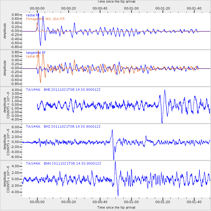
Signal To Noise
| Channel | StoN | STA | LTA |
| TA:U44A: :BHZ:20111021T08:14:30.900012Z | 2.4754698 | 5.80719E-7 | 2.3458942E-7 |
| TA:U44A: :BHN:20111021T08:14:30.900012Z | 0.61100245 | 5.143778E-7 | 8.418588E-7 |
| TA:U44A: :BHE:20111021T08:14:30.900012Z | 0.6545634 | 5.1163215E-7 | 7.816388E-7 |
| Arrivals |
| Ps | |
| PpPs | |
| PsPs/PpSs | |


