You are here: Home > Network List > TA - USArray Transportable Network (new EarthScope stations) Stations List
> Station W42A Bald Knob, AR, USA > Earthquake Result Viewer
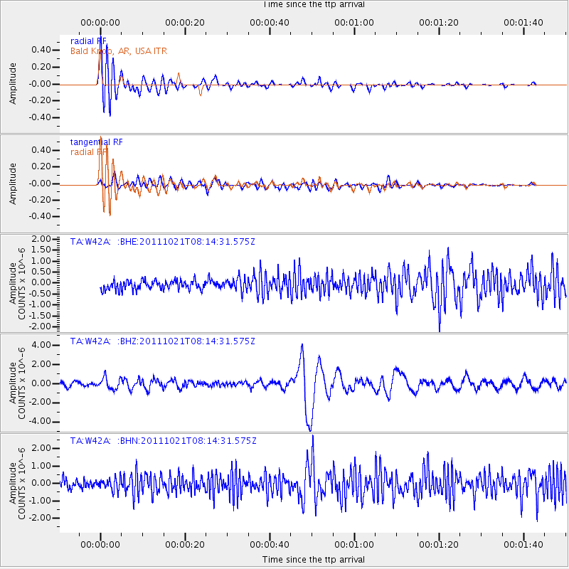
W42A Bald Knob, AR, USA - Earthquake Result Viewer
*The percent match for this event was below the threshold and hence no stack was calculated.
| Earthquake location: |
Hokkaido, Japan Region |
| Earthquake latitude/longitude: |
43.9/142.5 |
| Earthquake time(UTC): |
2011/10/21 (294) 08:02:37 GMT |
| Earthquake Depth: |
187 km |
| Earthquake Magnitude: |
5.9 MB, 6.1 MW, 6.1 MW |
| Earthquake Catalog/Contributor: |
WHDF/NEIC |
|
| Network: |
TA USArray Transportable Network (new EarthScope stations) |
| Station: |
W42A Bald Knob, AR, USA |
| Lat/Lon: |
35.27 N/91.52 W |
| Elevation: |
71 m |
|
| Distance: |
87.2 deg |
| Az: |
41.513 deg |
| Baz: |
324.153 deg |
| Ray Param: |
$rayparam |
*The percent match for this event was below the threshold and hence was not used in the summary stack. |
|
| Radial Match: |
76.451294 % |
| Radial Bump: |
400 |
| Transverse Match: |
63.849953 % |
| Transverse Bump: |
400 |
| SOD ConfigId: |
424168 |
| Insert Time: |
2012-02-10 01:49:49.949 +0000 |
| GWidth: |
2.5 |
| Max Bumps: |
400 |
| Tol: |
0.001 |
|
Signal To Noise
| Channel | StoN | STA | LTA |
| TA:W42A: :BHZ:20111021T08:14:31.575Z | 2.737866 | 5.7674293E-7 | 2.1065419E-7 |
| TA:W42A: :BHN:20111021T08:14:31.575Z | 0.9548359 | 3.2592564E-7 | 3.4134203E-7 |
| TA:W42A: :BHE:20111021T08:14:31.575Z | 1.4230487 | 2.8410253E-7 | 1.9964357E-7 |
| Arrivals |
| Ps | |
| PpPs | |
| PsPs/PpSs | |


