You are here: Home > Network List > TA - USArray Transportable Network (new EarthScope stations) Stations List
> Station N45A Kentland, IN, USA > Earthquake Result Viewer
N45A Kentland, IN, USA - Earthquake Result Viewer
*The percent match for this event was below the threshold and hence no stack was calculated.
| Earthquake location: |
Hokkaido, Japan Region |
| Earthquake latitude/longitude: |
43.9/142.5 |
| Earthquake time(UTC): |
2011/10/21 (294) 08:02:37 GMT |
| Earthquake Depth: |
187 km |
| Earthquake Magnitude: |
5.9 MB, 6.1 MW, 6.1 MW |
| Earthquake Catalog/Contributor: |
WHDF/NEIC |
|
| Network: |
TA USArray Transportable Network (new EarthScope stations) |
| Station: |
N45A Kentland, IN, USA |
| Lat/Lon: |
40.85 N/87.51 W |
| Elevation: |
206 m |
|
| Distance: |
84.4 deg |
| Az: |
35.721 deg |
| Baz: |
326.192 deg |
| Ray Param: |
$rayparam |
*The percent match for this event was below the threshold and hence was not used in the summary stack. |
|
| Radial Match: |
75.13494 % |
| Radial Bump: |
375 |
| Transverse Match: |
49.759872 % |
| Transverse Bump: |
400 |
| SOD ConfigId: |
424168 |
| Insert Time: |
2012-02-10 01:55:17.314 +0000 |
| GWidth: |
2.5 |
| Max Bumps: |
400 |
| Tol: |
0.001 |
|
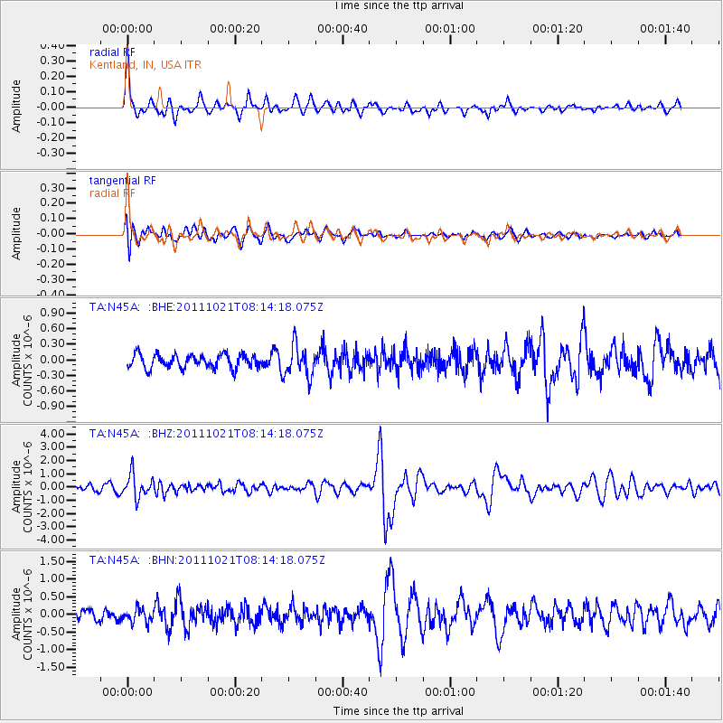
Signal To Noise
| Channel | StoN | STA | LTA |
| TA:N45A: :BHZ:20111021T08:14:18.075Z | 3.415556 | 8.859067E-7 | 2.5937408E-7 |
| TA:N45A: :BHN:20111021T08:14:18.075Z | 0.91960967 | 1.8887465E-7 | 2.0538567E-7 |
| TA:N45A: :BHE:20111021T08:14:18.075Z | 2.303072 | 3.0304506E-7 | 1.3158296E-7 |
| Arrivals |
| Ps | |
| PpPs | |
| PsPs/PpSs | |


