You are here: Home > Network List > UW - Pacific Northwest Regional Seismic Network Stations List
> Station LEBA Lebam, WA, USA > Earthquake Result Viewer
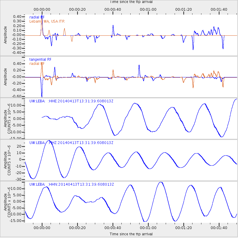
LEBA Lebam, WA, USA - Earthquake Result Viewer
*The percent match for this event was below the threshold and hence no stack was calculated.
| Earthquake location: |
Solomon Islands |
| Earthquake latitude/longitude: |
-6.7/154.9 |
| Earthquake time(UTC): |
2014/04/13 (103) 13:19:19 GMT |
| Earthquake Depth: |
35 km |
| Earthquake Magnitude: |
5.3 mb |
| Earthquake Catalog/Contributor: |
ISC/ISC |
|
| Network: |
UW Pacific Northwest Regional Seismic Network |
| Station: |
LEBA Lebam, WA, USA |
| Lat/Lon: |
46.55 N/123.56 W |
| Elevation: |
73 m |
|
| Distance: |
89.0 deg |
| Az: |
43.056 deg |
| Baz: |
259.235 deg |
| Ray Param: |
$rayparam |
*The percent match for this event was below the threshold and hence was not used in the summary stack. |
|
| Radial Match: |
79.97996 % |
| Radial Bump: |
400 |
| Transverse Match: |
89.989136 % |
| Transverse Bump: |
316 |
| SOD ConfigId: |
3390531 |
| Insert Time: |
2019-04-11 09:21:57.431 +0000 |
| GWidth: |
2.5 |
| Max Bumps: |
400 |
| Tol: |
0.001 |
|
Signal To Noise
| Channel | StoN | STA | LTA |
| UW:LEBA: :HHZ:20140413T13:31:39.608013Z | 1.5049921 | 2.2642404E-5 | 1.5044865E-5 |
| UW:LEBA: :HHN:20140413T13:31:39.608013Z | 1.3037367 | 1.0775168E-5 | 8.264835E-6 |
| UW:LEBA: :HHE:20140413T13:31:39.608013Z | 3.2868204 | 1.0100845E-5 | 3.073136E-6 |
| Arrivals |
| Ps | |
| PpPs | |
| PsPs/PpSs | |


