You are here: Home > Network List > UW - Pacific Northwest Regional Seismic Network Stations List
> Station LEBA Lebam, WA, USA > Earthquake Result Viewer
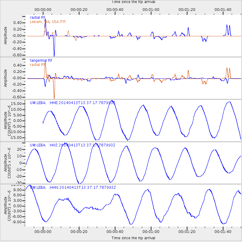
LEBA Lebam, WA, USA - Earthquake Result Viewer
*The percent match for this event was below the threshold and hence no stack was calculated.
| Earthquake location: |
Solomon Islands |
| Earthquake latitude/longitude: |
-11.1/162.0 |
| Earthquake time(UTC): |
2014/04/13 (103) 13:25:03 GMT |
| Earthquake Depth: |
35 km |
| Earthquake Magnitude: |
6.6 MWW, 6.7 MWC |
| Earthquake Catalog/Contributor: |
NEIC PDE/NEIC COMCAT |
|
| Network: |
UW Pacific Northwest Regional Seismic Network |
| Station: |
LEBA Lebam, WA, USA |
| Lat/Lon: |
46.55 N/123.56 W |
| Elevation: |
73 m |
|
| Distance: |
87.5 deg |
| Az: |
41.713 deg |
| Baz: |
251.115 deg |
| Ray Param: |
$rayparam |
*The percent match for this event was below the threshold and hence was not used in the summary stack. |
|
| Radial Match: |
96.38276 % |
| Radial Bump: |
400 |
| Transverse Match: |
66.54814 % |
| Transverse Bump: |
400 |
| SOD ConfigId: |
3390531 |
| Insert Time: |
2019-04-11 09:26:01.175 +0000 |
| GWidth: |
2.5 |
| Max Bumps: |
400 |
| Tol: |
0.001 |
|
Signal To Noise
| Channel | StoN | STA | LTA |
| UW:LEBA: :HHZ:20140413T13:37:17.787993Z | 1.8595786 | 2.0958667E-5 | 1.1270655E-5 |
| UW:LEBA: :HHN:20140413T13:37:17.787993Z | 0.8989227 | 8.639459E-6 | 9.610903E-6 |
| UW:LEBA: :HHE:20140413T13:37:17.787993Z | 1.8428626 | 1.5415384E-5 | 8.364912E-6 |
| Arrivals |
| Ps | |
| PpPs | |
| PsPs/PpSs | |


