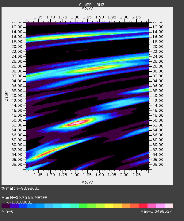
MPP McPhearson Peak - Earthquake Result Viewer
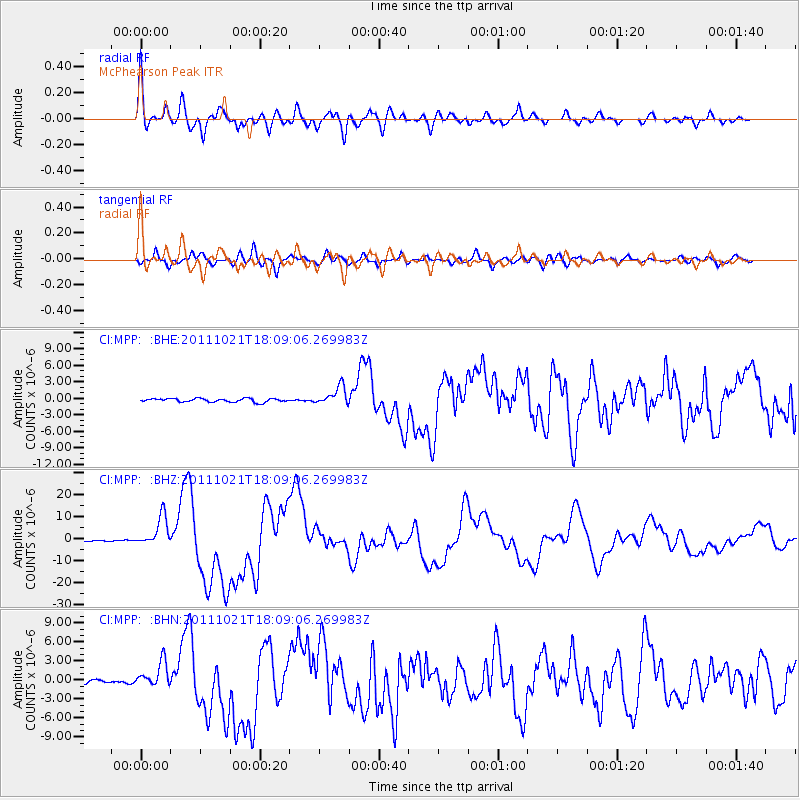
Earthquake location: Kermadec Islands Region
Earthquake latitude/longitude: -29.0/-176.2
Earthquake time(UTC): 2011/10/21 (294) 17:57:16 GMT
Earthquake Depth: 33 km
Earthquake Magnitude: 6.4 MB, 7.5 MS, 7.4 MW, 7.4 MW
Earthquake Catalog/Contributor: WHDF/NEIC
Network: CI Caltech Regional Seismic Network
Station: MPP McPhearson Peak
Lat/Lon: 34.89 N/119.81 W
Elevation: 1739 m
Distance: 82.9 deg
Az: 43.647 deg
Baz: 227.353 deg
Ray Param: 0.046527036
Estimated Moho Depth: 50.75 km
Estimated Crust Vp/Vs: 1.81
Assumed Crust Vp: 6.1 km/s
Estimated Crust Vs: 3.37 km/s
Estimated Crust Poisson's Ratio: 0.28
Radial Match: 93.98031 %
Radial Bump: 400
Transverse Match: 82.196365 %
Transverse Bump: 400
SOD ConfigId: 424168
Insert Time: 2012-02-10 02:19:39.226 +0000
GWidth: 2.5
Max Bumps: 400
Tol: 0.001

Signal To Noise

ChannelStoNSTALTA
CI:MPP: :BHZ:20111021T18:09:06.269983Z28.4826856.939925E-62.4365417E-7
CI:MPP: :BHN:20111021T18:09:06.269983Z6.8096562.0048803E-62.9441728E-7
CI:MPP: :BHE:20111021T18:09:06.269983Z5.35262781.6717696E-63.123269E-7
Arrivals
Ps6.9 SECOND
PpPs23 SECOND
PsPs/PpSs30 SECOND