MUR Murrieta - Earthquake Result Viewer
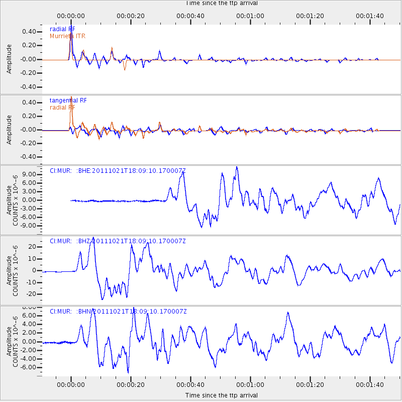
Earthquake location: Kermadec Islands Region
Earthquake latitude/longitude: -29.0/-176.2
Earthquake time(UTC): 2011/10/21 (294) 17:57:16 GMT
Earthquake Depth: 33 km
Earthquake Magnitude: 6.4 MB, 7.5 MS, 7.4 MW, 7.4 MW
Earthquake Catalog/Contributor: WHDF/NEIC
Network: CI Caltech Regional Seismic Network
Station: MUR Murrieta
Lat/Lon: 33.60 N/117.20 W
Elevation: 562 m
Distance: 83.7 deg
Az: 46.067 deg
Baz: 229.103 deg
Ray Param: 0.04598928
Estimated Moho Depth: 46.75 km
Estimated Crust Vp/Vs: 1.66
Assumed Crust Vp: 6.264 km/s
Estimated Crust Vs: 3.768 km/s
Estimated Crust Poisson's Ratio: 0.22
Radial Match: 98.38572 %
Radial Bump: 273
Transverse Match: 92.52547 %
Transverse Bump: 400
SOD ConfigId: 424168
Insert Time: 2012-02-10 02:21:11.645 +0000
GWidth: 2.5
Max Bumps: 400
Tol: 0.001

Signal To Noise

ChannelStoNSTALTA
CI:MUR: :BHZ:20111021T18:09:10.170007Z41.3003436.3995294E-61.5495101E-7
CI:MUR: :BHN:20111021T18:09:10.170007Z18.3930441.5942893E-68.667893E-8
CI:MUR: :BHE:20111021T18:09:10.170007Z17.934021.9441197E-61.08404016E-7
Arrivals
Ps5.1 SECOND
PpPs19 SECOND
PsPs/PpSs24 SECOND