You are here: Home > Network List > TA - USArray Transportable Network (new EarthScope stations) Stations List
> Station G59A Clarenceville, QC, USA > Earthquake Result Viewer
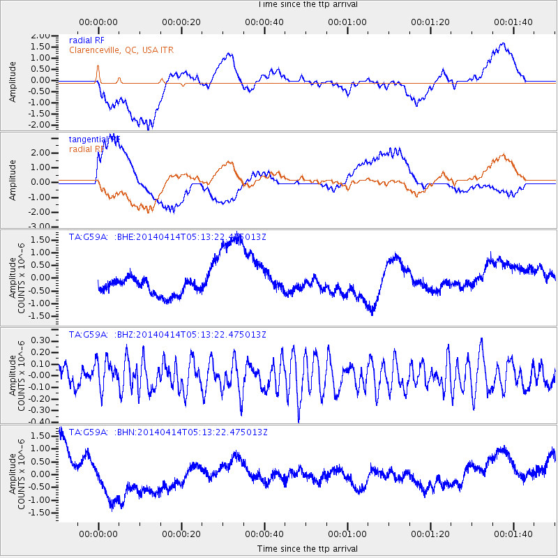
G59A Clarenceville, QC, USA - Earthquake Result Viewer
*The percent match for this event was below the threshold and hence no stack was calculated.
| Earthquake location: |
Nicaragua |
| Earthquake latitude/longitude: |
12.2/-86.3 |
| Earthquake time(UTC): |
2014/04/14 (104) 05:07:04 GMT |
| Earthquake Depth: |
17 km |
| Earthquake Magnitude: |
5.2 MW |
| Earthquake Catalog/Contributor: |
ISC/ISC |
|
| Network: |
TA USArray Transportable Network (new EarthScope stations) |
| Station: |
G59A Clarenceville, QC, USA |
| Lat/Lon: |
45.08 N/73.18 W |
| Elevation: |
36 m |
|
| Distance: |
34.7 deg |
| Az: |
16.475 deg |
| Baz: |
203.04 deg |
| Ray Param: |
$rayparam |
*The percent match for this event was below the threshold and hence was not used in the summary stack. |
|
| Radial Match: |
39.469154 % |
| Radial Bump: |
400 |
| Transverse Match: |
52.732433 % |
| Transverse Bump: |
400 |
| SOD ConfigId: |
3390531 |
| Insert Time: |
2019-04-11 09:31:27.631 +0000 |
| GWidth: |
2.5 |
| Max Bumps: |
400 |
| Tol: |
0.001 |
|
Signal To Noise
| Channel | StoN | STA | LTA |
| TA:G59A: :BHZ:20140414T05:13:22.475013Z | 1.1379529 | 1.2427459E-7 | 1.0920891E-7 |
| TA:G59A: :BHN:20140414T05:13:22.475013Z | 1.7407866 | 1.21834E-6 | 6.99879E-7 |
| TA:G59A: :BHE:20140414T05:13:22.475013Z | 5.8854012 | 1.7597733E-6 | 2.9900653E-7 |
| Arrivals |
| Ps | |
| PpPs | |
| PsPs/PpSs | |


