You are here: Home > Network List > UW - Pacific Northwest Regional Seismic Network Stations List
> Station LEBA Lebam, WA, USA > Earthquake Result Viewer
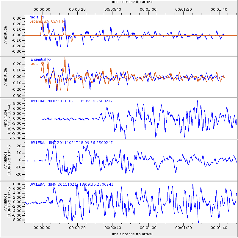
LEBA Lebam, WA, USA - Earthquake Result Viewer
*The percent match for this event was below the threshold and hence no stack was calculated.
| Earthquake location: |
Kermadec Islands Region |
| Earthquake latitude/longitude: |
-29.0/-176.2 |
| Earthquake time(UTC): |
2011/10/21 (294) 17:57:16 GMT |
| Earthquake Depth: |
33 km |
| Earthquake Magnitude: |
6.4 MB, 7.5 MS, 7.4 MW, 7.4 MW |
| Earthquake Catalog/Contributor: |
WHDF/NEIC |
|
| Network: |
UW Pacific Northwest Regional Seismic Network |
| Station: |
LEBA Lebam, WA, USA |
| Lat/Lon: |
46.55 N/123.56 W |
| Elevation: |
73 m |
|
| Distance: |
89.0 deg |
| Az: |
33.294 deg |
| Baz: |
224.167 deg |
| Ray Param: |
$rayparam |
*The percent match for this event was below the threshold and hence was not used in the summary stack. |
|
| Radial Match: |
93.81212 % |
| Radial Bump: |
400 |
| Transverse Match: |
90.824745 % |
| Transverse Bump: |
400 |
| SOD ConfigId: |
424168 |
| Insert Time: |
2012-02-10 02:40:59.908 +0000 |
| GWidth: |
2.5 |
| Max Bumps: |
400 |
| Tol: |
0.001 |
|
Signal To Noise
| Channel | StoN | STA | LTA |
| UW:LEBA: :BHZ:20111021T18:09:36.250024Z | 27.865654 | 6.460751E-6 | 2.3185356E-7 |
| UW:LEBA: :BHN:20111021T18:09:36.250024Z | 4.647966 | 9.993604E-7 | 2.1501026E-7 |
| UW:LEBA: :BHE:20111021T18:09:36.250024Z | 4.8143764 | 1.3789149E-6 | 2.864161E-7 |
| Arrivals |
| Ps | |
| PpPs | |
| PsPs/PpSs | |


