You are here: Home > Network List > TA - USArray Transportable Network (new EarthScope stations) Stations List
> Station G59A Clarenceville, QC, USA > Earthquake Result Viewer
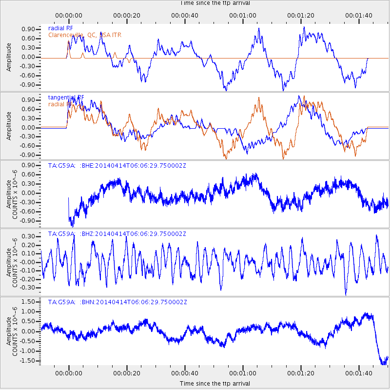
G59A Clarenceville, QC, USA - Earthquake Result Viewer
*The percent match for this event was below the threshold and hence no stack was calculated.
| Earthquake location: |
Near Coast Of Northern Chile |
| Earthquake latitude/longitude: |
-20.7/-70.7 |
| Earthquake time(UTC): |
2014/04/14 (104) 05:56:20 GMT |
| Earthquake Depth: |
30 km |
| Earthquake Magnitude: |
5.3 MW |
| Earthquake Catalog/Contributor: |
ISC/ISC |
|
| Network: |
TA USArray Transportable Network (new EarthScope stations) |
| Station: |
G59A Clarenceville, QC, USA |
| Lat/Lon: |
45.08 N/73.18 W |
| Elevation: |
36 m |
|
| Distance: |
65.5 deg |
| Az: |
358.047 deg |
| Baz: |
177.419 deg |
| Ray Param: |
$rayparam |
*The percent match for this event was below the threshold and hence was not used in the summary stack. |
|
| Radial Match: |
31.047554 % |
| Radial Bump: |
400 |
| Transverse Match: |
44.303925 % |
| Transverse Bump: |
400 |
| SOD ConfigId: |
3390531 |
| Insert Time: |
2019-04-11 09:39:37.983 +0000 |
| GWidth: |
2.5 |
| Max Bumps: |
400 |
| Tol: |
0.001 |
|
Signal To Noise
| Channel | StoN | STA | LTA |
| TA:G59A: :BHZ:20140414T06:06:29.750002Z | 1.3847814 | 1.7163309E-7 | 1.2394237E-7 |
| TA:G59A: :BHN:20140414T06:06:29.750002Z | 0.44249293 | 3.0192766E-7 | 6.823333E-7 |
| TA:G59A: :BHE:20140414T06:06:29.750002Z | 0.40401334 | 1.559773E-7 | 3.8606967E-7 |
| Arrivals |
| Ps | |
| PpPs | |
| PsPs/PpSs | |


