You are here: Home > Network List > TA - USArray Transportable Network (new EarthScope stations) Stations List
> Station P36A Good Intent, Atchison, KS, USA > Earthquake Result Viewer
P36A Good Intent, Atchison, KS, USA - Earthquake Result Viewer

| Earthquake location: |
Turkey |
| Earthquake latitude/longitude: |
38.7/43.5 |
| Earthquake time(UTC): |
2011/10/23 (296) 10:41:22 GMT |
| Earthquake Depth: |
16 km |
| Earthquake Magnitude: |
6.9 MB, 7.3 MS, 7.3 MW, 7.1 MW |
| Earthquake Catalog/Contributor: |
WHDF/NEIC |
|
| Network: |
TA USArray Transportable Network (new EarthScope stations) |
| Station: |
P36A Good Intent, Atchison, KS, USA |
| Lat/Lon: |
39.62 N/95.21 W |
| Elevation: |
313 m |
|
| Distance: |
93.3 deg |
| Az: |
329.306 deg |
| Baz: |
31.129 deg |
| Ray Param: |
0.041276507 |
| Estimated Moho Depth: |
39.25 km |
| Estimated Crust Vp/Vs: |
1.89 |
| Assumed Crust Vp: |
6.498 km/s |
| Estimated Crust Vs: |
3.433 km/s |
| Estimated Crust Poisson's Ratio: |
0.31 |
|
| Radial Match: |
96.20168 % |
| Radial Bump: |
400 |
| Transverse Match: |
87.84525 % |
| Transverse Bump: |
400 |
| SOD ConfigId: |
424168 |
| Insert Time: |
2012-02-16 05:45:45.067 +0000 |
| GWidth: |
2.5 |
| Max Bumps: |
400 |
| Tol: |
0.001 |
|
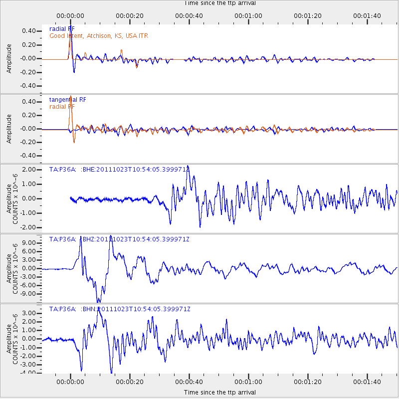
Signal To Noise
| Channel | StoN | STA | LTA |
| TA:P36A: :BHZ:20111023T10:54:05.399971Z | 46.20306 | 4.2008187E-6 | 9.0920786E-8 |
| TA:P36A: :BHN:20111023T10:54:05.399971Z | 13.853375 | 1.3833642E-6 | 9.985755E-8 |
| TA:P36A: :BHE:20111023T10:54:05.399971Z | 9.361745 | 7.00934E-7 | 7.4872155E-8 |
| Arrivals |
| Ps | 5.5 SECOND |
| PpPs | 17 SECOND |
| PsPs/PpSs | 23 SECOND |


