You are here: Home > Network List > TA - USArray Transportable Network (new EarthScope stations) Stations List
> Station O40A La Belle, MO, USA > Earthquake Result Viewer
O40A La Belle, MO, USA - Earthquake Result Viewer

| Earthquake location: |
Turkey |
| Earthquake latitude/longitude: |
38.7/43.5 |
| Earthquake time(UTC): |
2011/10/23 (296) 10:41:22 GMT |
| Earthquake Depth: |
16 km |
| Earthquake Magnitude: |
6.9 MB, 7.3 MS, 7.3 MW, 7.1 MW |
| Earthquake Catalog/Contributor: |
WHDF/NEIC |
|
| Network: |
TA USArray Transportable Network (new EarthScope stations) |
| Station: |
O40A La Belle, MO, USA |
| Lat/Lon: |
40.12 N/91.87 W |
| Elevation: |
206 m |
|
| Distance: |
91.6 deg |
| Az: |
327.402 deg |
| Baz: |
33.338 deg |
| Ray Param: |
0.04159012 |
| Estimated Moho Depth: |
23.75 km |
| Estimated Crust Vp/Vs: |
1.60 |
| Assumed Crust Vp: |
6.498 km/s |
| Estimated Crust Vs: |
4.061 km/s |
| Estimated Crust Poisson's Ratio: |
0.18 |
|
| Radial Match: |
97.83158 % |
| Radial Bump: |
400 |
| Transverse Match: |
87.45904 % |
| Transverse Bump: |
400 |
| SOD ConfigId: |
424168 |
| Insert Time: |
2012-02-16 05:59:24.443 +0000 |
| GWidth: |
2.5 |
| Max Bumps: |
400 |
| Tol: |
0.001 |
|
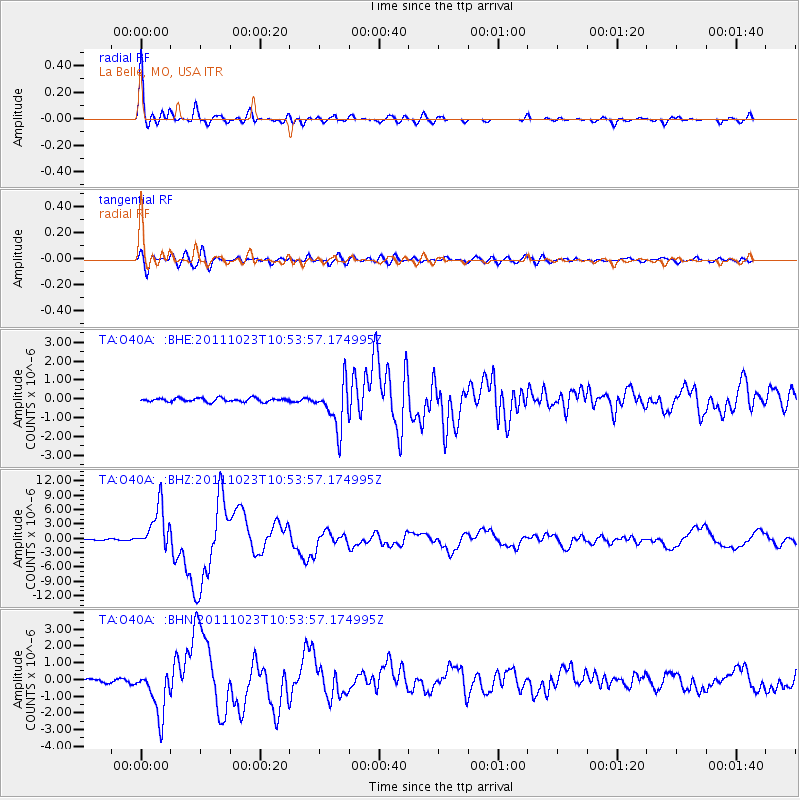
Signal To Noise
| Channel | StoN | STA | LTA |
| TA:O40A: :BHZ:20111023T10:53:57.174995Z | 40.363926 | 4.520523E-6 | 1.11994126E-7 |
| TA:O40A: :BHN:20111023T10:53:57.174995Z | 13.611526 | 1.4078271E-6 | 1.0342905E-7 |
| TA:O40A: :BHE:20111023T10:53:57.174995Z | 12.301996 | 1.1856253E-6 | 9.637665E-8 |
| Arrivals |
| Ps | 2.2 SECOND |
| PpPs | 9.3 SECOND |
| PsPs/PpSs | 12 SECOND |


