You are here: Home > Network List > TA - USArray Transportable Network (new EarthScope stations) Stations List
> Station 142A Monroe, LA, USA > Earthquake Result Viewer
142A Monroe, LA, USA - Earthquake Result Viewer

| Earthquake location: |
Turkey |
| Earthquake latitude/longitude: |
38.7/43.5 |
| Earthquake time(UTC): |
2011/10/23 (296) 10:41:22 GMT |
| Earthquake Depth: |
16 km |
| Earthquake Magnitude: |
6.9 MB, 7.3 MS, 7.3 MW, 7.1 MW |
| Earthquake Catalog/Contributor: |
WHDF/NEIC |
|
| Network: |
TA USArray Transportable Network (new EarthScope stations) |
| Station: |
142A Monroe, LA, USA |
| Lat/Lon: |
32.55 N/91.95 W |
| Elevation: |
23 m |
|
| Distance: |
97.9 deg |
| Az: |
323.269 deg |
| Baz: |
33.637 deg |
| Ray Param: |
0.040071145 |
| Estimated Moho Depth: |
37.25 km |
| Estimated Crust Vp/Vs: |
1.70 |
| Assumed Crust Vp: |
6.201 km/s |
| Estimated Crust Vs: |
3.659 km/s |
| Estimated Crust Poisson's Ratio: |
0.23 |
|
| Radial Match: |
94.38815 % |
| Radial Bump: |
400 |
| Transverse Match: |
89.45503 % |
| Transverse Bump: |
400 |
| SOD ConfigId: |
424168 |
| Insert Time: |
2012-02-16 06:08:35.095 +0000 |
| GWidth: |
2.5 |
| Max Bumps: |
400 |
| Tol: |
0.001 |
|
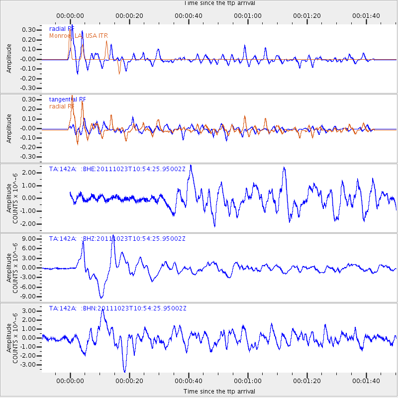
Signal To Noise
| Channel | StoN | STA | LTA |
| TA:142A: :BHZ:20111023T10:54:25.95002Z | 23.8598 | 3.1684779E-6 | 1.3279565E-7 |
| TA:142A: :BHN:20111023T10:54:25.95002Z | 3.147173 | 8.150968E-7 | 2.5899334E-7 |
| TA:142A: :BHE:20111023T10:54:25.95002Z | 3.24569 | 5.6735377E-7 | 1.7480221E-7 |
| Arrivals |
| Ps | 4.3 SECOND |
| PpPs | 16 SECOND |
| PsPs/PpSs | 20 SECOND |


