You are here: Home > Network List > TA - USArray Transportable Network (new EarthScope stations) Stations List
> Station Y44A Strider, Charleston, MS, USA > Earthquake Result Viewer
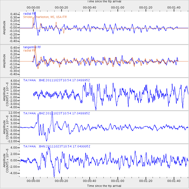
Y44A Strider, Charleston, MS, USA - Earthquake Result Viewer
*The percent match for this event was below the threshold and hence no stack was calculated.
| Earthquake location: |
Turkey |
| Earthquake latitude/longitude: |
38.7/43.5 |
| Earthquake time(UTC): |
2011/10/23 (296) 10:41:22 GMT |
| Earthquake Depth: |
16 km |
| Earthquake Magnitude: |
6.9 MB, 7.3 MS, 7.3 MW, 7.1 MW |
| Earthquake Catalog/Contributor: |
WHDF/NEIC |
|
| Network: |
TA USArray Transportable Network (new EarthScope stations) |
| Station: |
Y44A Strider, Charleston, MS, USA |
| Lat/Lon: |
33.96 N/90.21 W |
| Elevation: |
46 m |
|
| Distance: |
95.9 deg |
| Az: |
322.853 deg |
| Baz: |
34.633 deg |
| Ray Param: |
$rayparam |
*The percent match for this event was below the threshold and hence was not used in the summary stack. |
|
| Radial Match: |
90.45464 % |
| Radial Bump: |
400 |
| Transverse Match: |
81.64677 % |
| Transverse Bump: |
400 |
| SOD ConfigId: |
424168 |
| Insert Time: |
2012-02-16 06:11:24.398 +0000 |
| GWidth: |
2.5 |
| Max Bumps: |
400 |
| Tol: |
0.001 |
|
Signal To Noise
| Channel | StoN | STA | LTA |
| TA:Y44A: :BHZ:20111023T10:54:17.049995Z | 19.281576 | 4.3932087E-6 | 2.278449E-7 |
| TA:Y44A: :BHN:20111023T10:54:17.049995Z | 2.1935055 | 1.315589E-6 | 5.997655E-7 |
| TA:Y44A: :BHE:20111023T10:54:17.049995Z | 2.1989887 | 1.2953931E-6 | 5.8908586E-7 |
| Arrivals |
| Ps | |
| PpPs | |
| PsPs/PpSs | |


